
IMAGES TAKEN NEAR TO
Catterlen, PENRITH, CA11 0BD
Introduction
This page details the photographs taken nearby to CA11 0BD by members of the Geograph project.
The Geograph project started in 2005 with the aim of publishing, organising and preserving representative images for every square kilometre of Great Britain, Ireland and the Isle of Man.

There are currently over 7.5m images from over14,400 individuals and you can help contribute to the project by visiting https://www.geograph.org.uk
Image Map
Images are licensed for reuse under creativecommons.org/licenses/by-sa/2.0
Notes
- Clicking on the map will re-center to the selected point.
- The higher the marker number, the further away the image location is from the centre of the postcode.
Image Listing (20 Images Found)
Images are licensed for reuse under creativecommons.org/licenses/by-sa/2.0
Image
Details
Distance
1
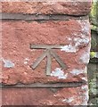
OS Cut Mark - Catterlen, Honey House
Cut Mark Honey House NE ANG E FACE (ODN 193.4769m, AGL 0.8m).
Image: © thejackrustles
Taken: 13 Apr 2018
0.00 miles
2
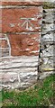
Benchmark on Honey House on west side of rural road
Cement-filled Ordnance Survey cut mark benchmark levelled at 193.477m above Newlyn Datum verified 1970
Image: © Roger Templeman
Taken: 8 Jul 2022
0.00 miles
3
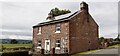
Honey House on west side of road south of High Dyke
There is an Ordnance Survey benchmark Image on the far corner, road face, of the house
Image: © Roger Templeman
Taken: 8 Jul 2022
0.00 miles
4
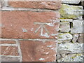
Ordnance Survey Cut Mark
This mark can be found on the roadside wall of Honey House.
The benchmark has a recorded height of 193.4796 metres above sea level.
For more detail see : https://www.bench-marks.org.uk/bm77882
Image: © Peter Wood
Taken: 15 May 2021
0.01 miles
6
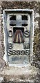
Benchmark on High Dyke triangulation pillar
Ordnance Survey flush bracket (serial identifier S6995) benchmark levelled at 197.803m above Newlyn Datum verified 1970
Image: © Roger Templeman
Taken: 8 Jul 2022
0.13 miles
7
T-junction at High Dyke
There is a Cumbria County Council finger signpost on the verge at the right hand side of the road
Image: © Roger Templeman
Taken: 8 Jul 2022
0.13 miles
8
Road and house at Catterlen
The road is descending to the main part of the village from High Dyke.
Image: © Andrew Smith
Taken: 28 Sep 2008
0.13 miles

10
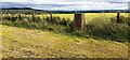
High Dyke triangulation pillar beside fence dividing arable fields
There is an Ordnance Survey flush bracket Image set into the pillar on its face away from the fence
Image: © Roger Templeman
Taken: 8 Jul 2022
0.14 miles