IMAGES TAKEN NEAR TO
Pooley Bridge, PENRITH, CA10 2LT
Introduction
This page details the photographs taken nearby to CA10 2LT by members of the Geograph project.
The Geograph project started in 2005 with the aim of publishing, organising and preserving representative images for every square kilometre of Great Britain, Ireland and the Isle of Man.

There are currently over 7.5m images from over14,400 individuals and you can help contribute to the project by visiting https://www.geograph.org.uk
Image Map
Images are licensed for reuse under creativecommons.org/licenses/by-sa/2.0
Notes
- Clicking on the map will re-center to the selected point.
- The higher the marker number, the further away the image location is from the centre of the postcode.
Image Listing (9 Images Found)
Images are licensed for reuse under creativecommons.org/licenses/by-sa/2.0
Image
Details
Distance
1
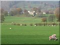
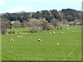
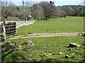
Grassland at Roehouse
Looking across grassland being grazed by sheep at Roehouse. The buildings of Elderburn are visible in the distance.
Image: © Graham Robson
Taken: 31 Oct 2014
0.07 miles
2
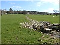
Field and ditch below Howe Hill
The ditch has been filled with stones.
Image: © Oliver Dixon
Taken: 11 Apr 2019
0.16 miles
4
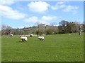
Sheep in field at Elderbeck Farm
Roehead Farm can be seen between the trees.
Image: © Oliver Dixon
Taken: 11 Apr 2019
0.18 miles
6
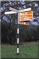
Direction sign at the crossroads east of Pooley Bridge
The directional sign giving directions to a variety of destinations from the crossroads at the east end of High Street, Pooley Bridge.
Image: © Graham Robson
Taken: 31 Oct 2014
0.20 miles
7
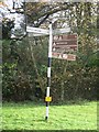
Old Direction Sign - Signpost by Pooley Bridge, Barton parish
Crown finial - 3 arms; Westmorland crown by the UC road, in parish of Barton (Eden District), Pooley Bridge.
Surveyed
Milestone Society National ID: WE_NY4724A
Image: © Milestone Society
Taken: Unknown
0.20 miles
8
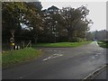
Crossroads east of Pooley Bridge
The crossroads at the east end of High Street, Pooley Bridge.
Image: © Graham Robson
Taken: 31 Oct 2014
0.21 miles
9
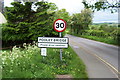
Entering Pooley Bridge
Entering the community from the south east.
Image: © Chris Heaton
Taken: 2 Jan 2003
0.22 miles