IMAGES TAKEN NEAR TO
Carrick Avenue, STRABANE, BT82 9RY
Introduction
This page details the photographs taken nearby to Carrick Avenue, BT82 9RY by members of the Geograph project.
The Geograph project started in 2005 with the aim of publishing, organising and preserving representative images for every square kilometre of Great Britain, Ireland and the Isle of Man.

There are currently over 7.5m images from over14,400 individuals and you can help contribute to the project by visiting https://www.geograph.org.uk
Image Map
Images are licensed for reuse under creativecommons.org/licenses/by-sa/2.0
Notes
- Clicking on the map will re-center to the selected point.
- The higher the marker number, the further away the image location is from the centre of the postcode.
Image Listing (2 Images Found)
Images are licensed for reuse under creativecommons.org/licenses/by-sa/2.0
Image
Details
Distance
1
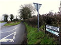
Carrick Avenue, Carricklee
Heading ENE from Urney Road
Image: © Kenneth Allen
Taken: 17 Feb 2015
0.04 miles
2
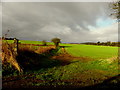
Carricklee Townland
Pictured along Carrick Avenue, I remember going to a point to point horse race here some time in the 1960s and losing 6 shillings, betting on a race, never won, so never ever placed a bet again.
Image: © Kenneth Allen
Taken: 17 Feb 2015
0.23 miles