IMAGES TAKEN NEAR TO
Mourne Villas, STRABANE, BT82 8BG
Introduction
This page details the photographs taken nearby to Mourne Villas, BT82 8BG by members of the Geograph project.
The Geograph project started in 2005 with the aim of publishing, organising and preserving representative images for every square kilometre of Great Britain, Ireland and the Isle of Man.

There are currently over 7.5m images from over14,400 individuals and you can help contribute to the project by visiting https://www.geograph.org.uk
Image Map
Images are licensed for reuse under creativecommons.org/licenses/by-sa/2.0
Notes
- Clicking on the map will re-center to the selected point.
- The higher the marker number, the further away the image location is from the centre of the postcode.
Image Listing (358 Images Found)
Images are licensed for reuse under creativecommons.org/licenses/by-sa/2.0
Image
Details
Distance
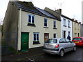
1
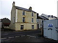
Town house, Strabane
Pictured along Lower Main Street - where's the door?
Image: © Kenneth Allen
Taken: 10 Nov 2014
0.02 miles
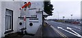
2
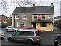
Laundrette, Strabane
It is located along Main Street
Image: © Kenneth Allen
Taken: 6 Jan 2012
0.03 miles
3
Koram Centre, Strabane
It is located along Main Street
More at http://www.koramcentre.com/home/
Image: © Kenneth Allen
Taken: 6 Jan 2012
0.03 miles
4
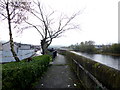
Flood retaining wall, Strabane
Looking south-east along the River Mourne
Image: © Kenneth Allen
Taken: 10 Nov 2014
0.06 miles
5
Garage, Strabane
It is located along the river
Image: © Kenneth Allen
Taken: 6 Jan 2012
0.07 miles
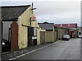
6
House with virtual front, Strabane
Looks much better than the last time I was here
Image: © Kenneth Allen
Taken: 10 Nov 2014
0.07 miles
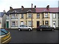
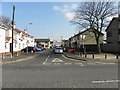
7
Eden Terrace, Strabane
Heading north towards Railway Street
Image: © Kenneth Allen
Taken: 10 Nov 2014
0.07 miles
8
Alexander Place, Strabane
Pictured along Lower Main Street
Image: © Kenneth Allen
Taken: 9 Apr 2013
0.07 miles
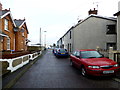
9
Railway Street, Street
A railway enthusiast must live here.
Image: © Kenneth Allen
Taken: 15 Jan 2008
0.08 miles
10
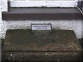
Plaque, Railway Street
It depicts the fact that a well known area of Strabane called the Camel's Hump used to exist at a railway bridge between the town and Lifford. For many years it was the location of a checkpoint by the army.
Image: © Kenneth Allen
Taken: 15 Jan 2008
0.08 miles