IMAGES TAKEN NEAR TO
Castlefin Road, CASTLEDERG, BT81 7EE
Introduction
This page details the photographs taken nearby to Castlefin Road, BT81 7EE by members of the Geograph project.
The Geograph project started in 2005 with the aim of publishing, organising and preserving representative images for every square kilometre of Great Britain, Ireland and the Isle of Man.

There are currently over 7.5m images from over14,400 individuals and you can help contribute to the project by visiting https://www.geograph.org.uk
Image Map
Images are licensed for reuse under creativecommons.org/licenses/by-sa/2.0
Notes
- Clicking on the map will re-center to the selected point.
- The higher the marker number, the further away the image location is from the centre of the postcode.
Image Listing (7 Images Found)
Images are licensed for reuse under creativecommons.org/licenses/by-sa/2.0
Image
Details
Distance
1
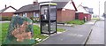
Standing stone at Castlederg
There's not many standing stones about that you could make a landline call from.
Image: © Kenneth Allen
Taken: 27 Mar 2007
0.07 miles
2
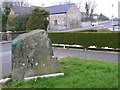
Standing stone, Castlederg
Another view to the north-west
Image: © Kenneth Allen
Taken: 27 Mar 2007
0.07 miles
3
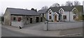
House at Castlederg
My attention was drawn to the stone walled outbuildings which are in immaculate condition.
Image: © Kenneth Allen
Taken: 27 Mar 2007
0.07 miles
4
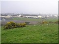
Ground overlooking Castlederg
I was looking for a chambered grave marked on the map but there were so many stones in the field that I gave up.
Image: © Kenneth Allen
Taken: 27 Mar 2007
0.22 miles
5
Approaching Castlederg
Heading south towards the town.
Image: © Kenneth Allen
Taken: 27 Mar 2007
0.22 miles
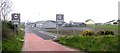
6

Building site
Housing construction off Ashleigh Court, Castlederg.
Image: © Richard Webb
Taken: 20 Jul 2012
0.23 miles
7
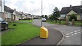
Ashleigh Court
New houses on the northwest side of Castlederg.
Image: © Richard Webb
Taken: 20 Jul 2012
0.23 miles