IMAGES TAKEN NEAR TO
Landahussy Road, OMAGH, BT79 8EJ
Introduction
This page details the photographs taken nearby to Landahussy Road, BT79 8EJ by members of the Geograph project.
The Geograph project started in 2005 with the aim of publishing, organising and preserving representative images for every square kilometre of Great Britain, Ireland and the Isle of Man.

There are currently over 7.5m images from over14,400 individuals and you can help contribute to the project by visiting https://www.geograph.org.uk
Image Map
Images are licensed for reuse under creativecommons.org/licenses/by-sa/2.0
Notes
- Clicking on the map will re-center to the selected point.
- The higher the marker number, the further away the image location is from the centre of the postcode.
Image Listing (26 Images Found)
Images are licensed for reuse under creativecommons.org/licenses/by-sa/2.0
Image
Details
Distance
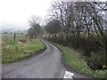
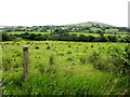
2
Trinamadan Road, Lower Drumnaspar
Heading NNE from Drumnaspar
No evidence of a road sign being provided here but there's one at the far end of the road Image]
Image: © Kenneth Allen
Taken: 10 Oct 2018
0.12 miles
3
Rough road, Lower Drumnaspar
No signposts but the maps suggest that this is an extension of Trinamadan Road
Image: © Kenneth Allen
Taken: 10 Oct 2018
0.12 miles
4
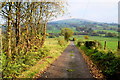
Fallen leaves along Trinamadan Road
Heading NNE at Lower Drumnaspar
Image: © Kenneth Allen
Taken: 10 Oct 2018
0.12 miles
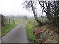
5
Trinamadan Road, Lower Drumnaspar
Heading NNE
Image: © Kenneth Allen
Taken: 20 Feb 2013
0.13 miles
6
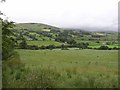
Landahussy Townland
The mist is still over the mountains
Image: © Kenneth Allen
Taken: 11 Jul 2006
0.13 miles
8
Trinamadan Road
Heading SSW at Lower Drumnaspar
Image: © Kenneth Allen
Taken: 20 Feb 2013
0.13 miles
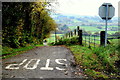
9
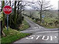
STOP, STOP - Lower Drumnaspar
Pictured along Trinamadan Road
Image: © Kenneth Allen
Taken: 20 Feb 2013
0.13 miles
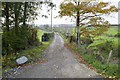
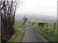
10
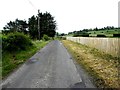
Landahussy Road
Heading east at Lower Dtrumnaspar
Image: © Kenneth Allen
Taken: 4 Jul 2013
0.14 miles