IMAGES TAKEN NEAR TO
Killyclogher Road, OMAGH, BT79 7NX
Introduction
This page details the photographs taken nearby to Killyclogher Road, BT79 7NX by members of the Geograph project.
The Geograph project started in 2005 with the aim of publishing, organising and preserving representative images for every square kilometre of Great Britain, Ireland and the Isle of Man.

There are currently over 7.5m images from over14,400 individuals and you can help contribute to the project by visiting https://www.geograph.org.uk
Image Map
Images are licensed for reuse under creativecommons.org/licenses/by-sa/2.0
Notes
- Clicking on the map will re-center to the selected point.
- The higher the marker number, the further away the image location is from the centre of the postcode.
Image Listing (85 Images Found)
Images are licensed for reuse under creativecommons.org/licenses/by-sa/2.0
Image
Details
Distance
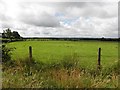
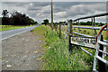
1
Tirquin Townland
Looking ENE from Glencurry Road
Image: © Kenneth Allen
Taken: 27 Jun 2022
0.02 miles
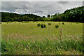
2
Tirquin Townland
Looking east from Glencurry Road
Image: © Kenneth Allen
Taken: 29 Jul 2013
0.03 miles
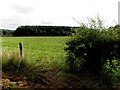
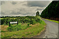
3

A505 From Omagh to Cookstown
Main road from Omagh to Cookstown- just before Mountfield.
Image: © Gordon Dunn
Taken: 28 Jan 2006
0.04 miles
4
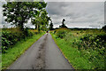
Glencurry Road
Heading north at Tirquin
Image: © Kenneth Allen
Taken: 27 Jun 2022
0.05 miles
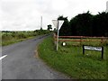
5
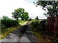
Killyclogher Road, Tirquin
Heading north-east from the junction with Glencurry Road
Image: © Kenneth Allen
Taken: 27 Jun 2022
0.05 miles
6
Glencurry Road
Heading NNW from Killyclogher Road
Image: © Kenneth Allen
Taken: 29 Jul 2013
0.05 miles
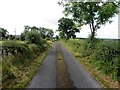
7
Glencurry Road, Tirquin
Heading NNW from Killyclogher Road
Image: © Kenneth Allen
Taken: 27 Jun 2022
0.05 miles
8
Glencurry Road
Heading south at Tirquin
Image: © Kenneth Allen
Taken: 29 Jul 2013
0.05 miles
9
Glencurry Road, Tirquin
Heading north
Image: © Kenneth Allen
Taken: 29 Jul 2013
0.07 miles