IMAGES TAKEN NEAR TO
Main Street, CALEDON, BT68 4TZ
Introduction
This page details the photographs taken nearby to Main Street, BT68 4TZ by members of the Geograph project.
The Geograph project started in 2005 with the aim of publishing, organising and preserving representative images for every square kilometre of Great Britain, Ireland and the Isle of Man.

There are currently over 7.5m images from over14,400 individuals and you can help contribute to the project by visiting https://www.geograph.org.uk
Image Map
Images are licensed for reuse under creativecommons.org/licenses/by-sa/2.0
Notes
- Clicking on the map will re-center to the selected point.
- The higher the marker number, the further away the image location is from the centre of the postcode.
Image Listing (155 Images Found)
Images are licensed for reuse under creativecommons.org/licenses/by-sa/2.0
Image
Details
Distance
1
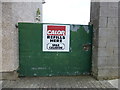
Calor sign, Caledon
Pictured along Main Street
Image: © Kenneth Allen
Taken: 30 Jul 2014
0.00 miles
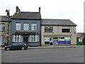
2

Main Street, Caledon
This information was read here Image]
HISTORY OF CALEDON
In the Middle Ages, Caledon, then known as Kinnard, was a strategic military settlement held by the O'Neill family. In 1498 Mac Art O'Neill was driven out by the Earl of Kildare then replaced by Turlough O 'Neill whose descendants owned the village up until the Ulster Rising of 1641. Following this Cromwell confiscated their property later granting it to the Hamilton family from whom it passed by marriage to the fifth Earl of Orrery. Some argue that William Hamilton named the town after his native Scotland (Caledonia),others believed that Caledon is a corruption of 'Culligan' (a town land within the demesne) or that the name has been derived from Irish ('Fort in the marshy meadow'). Caledon was built in the early 19th century by James Du Pre Alexander.
Image: © Kenneth Allen
Taken: 28 Aug 2013
0.01 miles
4
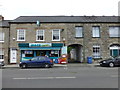
Mace, Caledon
It is located at Main Street
Image: © Kenneth Allen
Taken: 30 Jul 2014
0.02 miles
5
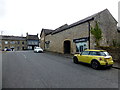
Derrycourtney Road, Caledon
Heading ENE towards Main Street - I spot a good name on the right!
Image: © Kenneth Allen
Taken: 30 Jul 2014
0.02 miles
6
Weighbridge, Caledon
Pictured along Main Street
See close-up of inscription here Image]
Image: © Kenneth Allen
Taken: 30 Jul 2014
0.02 miles

8
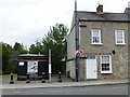
Allens, Caledon
Pictured at the corner of Derrycourtney Road and Main Street
Image: © Kenneth Allen
Taken: 30 Jul 2014
0.02 miles
9
Luxury toilet, Caledon
Located along Main Street - 20p to get in!
Image: © Kenneth Allen
Taken: 30 Jul 2014
0.02 miles
10
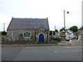
Former infant's school and fountain, Caledon
They are located at the corner of Derrycourtney Road and Main Street
The building was laterally used as a Church of Ireland hall
Image: © Kenneth Allen
Taken: 30 Jul 2014
0.02 miles