IMAGES TAKEN NEAR TO
Bloomfield Drive, BELFAST, BT5 5NY

Introduction

This page details the photographs taken nearby to Bloomfield Drive, BT5 5NY by members of the Geograph project.

The Geograph project started in 2005 with the aim of publishing, organising and preserving representative images for every square kilometre of Great Britain, Ireland and the Isle of Man.

There are currently over 7.5m images from over14,400 individuals and you can help contribute to the project by visiting https://www.geograph.org.uk

Image Map


Images are licensed for reuse under creativecommons.org/licenses/by-sa/2.0
Notes
  • Clicking on the map will re-center to the selected point.
  • The higher the marker number, the further away the image location is from the centre of the postcode.

Image Listing (213 Images Found)

Images are licensed for reuse under creativecommons.org/licenses/by-sa/2.0
  • ...
Image
Details
Distance
1
Bloomfield Street, Belfast (2)
The cast sign, with painted postal district number, at the Bloomfield Parade end (south western side) of Bloomfield Street Image Continue to Image
Image: © Albert Bridge Taken: 18 Feb 2011
0.03 miles
2
Bloomfield Street, Belfast (3)
See Image Bloomfield Street, looking in the opposite direction – from Factory Street Image The former Owen O’Cork mill Image is in the background.
Image: © Albert Bridge Taken: 22 Aug 2011
0.07 miles
3
Greenville Avenue, Belfast
A short, late 19th century street, now partly rebuilt, off the Beersbridge Road. The Connswater Shopping Centre is in the background.
Image: © Albert Bridge Taken: 22 Aug 2011
0.07 miles
4
Bloomfield Street, Belfast (1)
A street, built in the early part of the 20th century, of traditional terrace houses. Now tucked away behind the Connswater Shopping Centre, it and the adjoining streets are all cul-de-sacs. With no through traffic the area is so quiet that a whistling kettle can be heard at 100 yards. See also Image
Image: © Albert Bridge Taken: 18 Feb 2011
0.08 miles
5
Former mill chimney, Belfast
The chimney of the former Owen O’Cork mill Image on the Beersbridge Road. The mill, engine house, office and stores are listed as HB26/10/006.
Image: © Albert Bridge Taken: 15 Jul 2011
0.08 miles
6
The Owen O'Cork mill, Belfast (April 2016)
See Image (January 2010). The Owen O’Cork mill, Beersbridge Road, with a hole in the north eastern wall. Being a listed building this is probably covered by a planning permission but I cannot (at the time of submission) find it on the NI planning portal.
Image: © Albert Bridge Taken: 27 Apr 2016
0.09 miles
7
Factory Street, Belfast
A short street, once in the shadow of the Belfast Ropeworks, built in the late 19th century when it had but five houses and the factory of Ross Bros, damask manufacturers and finishers. There was also a longer Factory Street South.
Image: © Albert Bridge Taken: 22 Aug 2011
0.09 miles
8
The Owen O'Cork mill, Belfast
The Owen O’Cork Mill on the Beersbridge Road. Built in 1873, it replaced a corn mill from the mid-17th century. Formerly occupied by James McCann (linen merchant) and later by the Belfast Flax & Jute Co Ltd. Long closed and now used by the usual assortment of small businesses. The street’s name comes from the De Beers who owned the original corn mill. Continue to Image
Image: © Albert Bridge Taken: 25 Jan 2010
0.09 miles
9
Knock River footbridge, Belfast
At the rear of Bloomfield Parade. Tatty perhaps but the water is clean enough to support a flock of mallard.
Image: © Albert Bridge Taken: 25 Jan 2010
0.10 miles
10
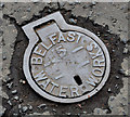
Belfast Water Works access cover, Belfast
A well-worn Belfast Water Works cover, on the Beersbridge Road, similar to Image Image shows a similar but in much less worn cover.
Image: © Albert Bridge Taken: 15 Jul 2011
0.10 miles
  • ...