IMAGES TAKEN NEAR TO
Beersbridge Road, BELFAST, BT5 5DS

Introduction

This page details the photographs taken nearby to Beersbridge Road, BT5 5DS by members of the Geograph project.

The Geograph project started in 2005 with the aim of publishing, organising and preserving representative images for every square kilometre of Great Britain, Ireland and the Isle of Man.

There are currently over 7.5m images from over14,400 individuals and you can help contribute to the project by visiting https://www.geograph.org.uk

Image Map


Images are licensed for reuse under creativecommons.org/licenses/by-sa/2.0
Notes
  • Clicking on the map will re-center to the selected point.
  • The higher the marker number, the further away the image location is from the centre of the postcode.

Image Listing (172 Images Found)

Images are licensed for reuse under creativecommons.org/licenses/by-sa/2.0
  • ...
Image
Details
Distance
1
Hyndford Street sign, Belfast
See Image The sign at the Beersbridge Road end. High enough to discourage (but probably not deter) souvenir hunters.
Image: © Albert Bridge Taken: 25 Jan 2010
0.01 miles
2
Topaz petrol station, Belfast (April 2016)
Topaz petrol station on the Beersbridge Road.
Image: © Albert Bridge Taken: 27 Apr 2016
0.01 miles
3
Pillar box, Belfast
EIIR pillar box on the Beersbridge Road. Hyndford Street Image is in the background.
Image: © Albert Bridge Taken: 18 Feb 2011
0.01 miles
4
20 mph speed limit sign, Beersbridge Road, Belfast (September 2015)
A 20mph speed limit sign at the Beersbridge Road end of Greenville Road – one of several similarly restricted streets in the general area.
Image: © Albert Bridge Taken: 12 Sep 2015
0.01 miles
5
The Owen O'Cork mill, Belfast (2)
See Image The plaque showing the date of building.
Image: © Albert Bridge Taken: 25 Jan 2010
0.01 miles
6
Development site, east Belfast
A terrace house, at the corner of the Beersbridge Road and Abetta Parade, offered for sale as an “excellent development opportunity” with planning permission for three apartments. Continue to Image – April 2012. Image shows the replacement.
Image: © Albert Bridge Taken: 18 Feb 2011
0.02 miles
7
The Owen O'Cork mill, Belfast
The Owen O’Cork Mill on the Beersbridge Road. Built in 1873, it replaced a corn mill from the mid-17th century. Formerly occupied by James McCann (linen merchant) and later by the Belfast Flax & Jute Co Ltd. Long closed and now used by the usual assortment of small businesses. The street’s name comes from the De Beers who owned the original corn mill. Continue to Image
Image: © Albert Bridge Taken: 25 Jan 2010
0.02 miles
8
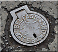
Belfast Water Works access cover, Belfast
A well-worn Belfast Water Works cover, on the Beersbridge Road, similar to Image Image shows a similar but in much less worn cover.
Image: © Albert Bridge Taken: 15 Jul 2011
0.02 miles
9
Proposed social housing, Beersbridge Road, Belfast - March 2018(2)
Part of the site, from Abetta Parade.
Image: © Albert Bridge Taken: 12 Mar 2018
0.03 miles
10
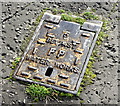
Belfast Water Works fire plug cover, Belfast (October 2017)
A Belfast Water Works fire plug cover, at the Beersbridge Road end of Abetta Parade.
Image: © Albert Bridge Taken: 23 Oct 2017
0.03 miles
  • ...