Development site, east Belfast
Introduction
The photograph on this page of Development site, east Belfast by Albert Bridge as part of the Geograph project.
The Geograph project started in 2005 with the aim of publishing, organising and preserving representative images for every square kilometre of Great Britain, Ireland and the Isle of Man.

There are currently over 7.5m images from over 14,400 individuals and you can help contribute to the project by visiting https://www.geograph.org.uk
Development site, east Belfast
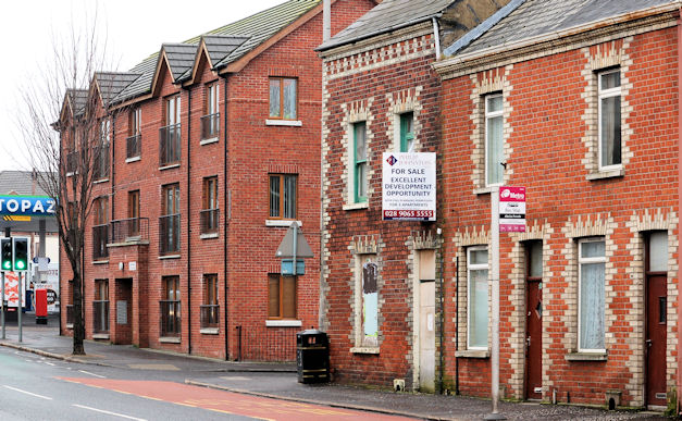
Image: © Albert Bridge Taken: 18 Feb 2011
A terrace house, at the corner of the Beersbridge Road and Abetta Parade, offered for sale as an “excellent development opportunity” with planning permission for three apartments. Continue to Image – April 2012. Image shows the replacement.
Images are licensed for reuse under creativecommons.org/licenses/by-sa/2.0
Image Location
Latitude
54.592405
Longitude
-5.889938