1
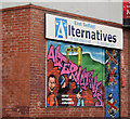
No 62 Beersbridge Road, Belfast - May 2018(1)
The vacant no 62 Beersbridge Road. Calvin Street is on the right.
Image: © Albert Bridge
Taken: 30 May 2018
0.02 miles
2
No 62 Beersbridge Road, Belfast - May 2018(2)
The vacant no 62 Beersbridge Road from the south. Part of Calvin Street can be seen at lower right.
Image: © Albert Bridge
Taken: 30 May 2018
0.02 miles
3
"Spence's" chippy, Belfast
The locally-famous east Belfast chippy, at the corner of Calvin Street and the Beersbridge Road (foreground) is now offered for sale.
Image: © Albert Bridge
Taken: 22 Dec 2011
0.02 miles
4
Nos 81&83 Castlereagh Road, Belfast (December 2017)
Shops, on the ground floor, with offices to let upstairs. Described by the agents as “The offices have been finished to a high standard to include plastered and painted walls, wooden laminate flooring and fluorescent strip lighting.” I have no connection with the property or the letting.
Image: © Albert Bridge
Taken: 7 Dec 2017
0.05 miles
5
Decorated shutter door, Belfast
Decorated shutter door, on premises formerly occupied by part of the “social economy”, at Isthmus Street
Image off the Woodstock Road.
Image: © Albert Bridge
Taken: 22 Dec 2011
0.07 miles
6
Datestone, Mountpottinger Presbyterian church, Belfast
The datestone (1869) above the entrance.
Image: © Albert Bridge
Taken: 13 Nov 2013
0.08 miles
7
Regeneration site, east Belfast (2)
A regeneration site, between Kenbaan Street and Clandeboye Street (right background).
Image: © Albert Bridge
Taken: 17 Oct 2012
0.08 miles
8
Mountpottinger Presbyterian church, Belfast
The church seen, across Castlereagh Street, from Paxton Street
Image: © Albert Bridge
Taken: 13 Nov 2013
0.08 miles
9
Nos 7-9 Upper Frank Street, Belfast (May 2018)
A block of former Belfast Corporation flats facing Calvin Street. Built, to the best of my knowledge, in the 1950’s to replace terrace houses bombed by the Luftwaffe.
The original houses seem to have been in existence before 1887.
Image: © Albert Bridge
Taken: 30 May 2018
0.08 miles
10
Isthmus Street sign, Belfast
The original Isthmus Street was a late Victorian creation of 15 houses. Now redeveloped, there are no houses at the Woodstock Road end so the name sign is mounted on posts.
Image: © Albert Bridge
Taken: 22 Dec 2011
0.08 miles


