
IMAGES TAKEN NEAR TO
Clandeboye Drive, BELFAST, BT5 4PF
Introduction
This page details the photographs taken nearby to Clandeboye Drive, BT5 4PF by members of the Geograph project.
The Geograph project started in 2005 with the aim of publishing, organising and preserving representative images for every square kilometre of Great Britain, Ireland and the Isle of Man.

There are currently over 7.5m images from over14,400 individuals and you can help contribute to the project by visiting https://www.geograph.org.uk
Image Map
Images are licensed for reuse under creativecommons.org/licenses/by-sa/2.0
Notes
- Clicking on the map will re-center to the selected point.
- The higher the marker number, the further away the image location is from the centre of the postcode.
Image Listing (251 Images Found)
Images are licensed for reuse under creativecommons.org/licenses/by-sa/2.0
Image
Details
Distance
1
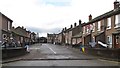
Welcome to Cluan Place
Cluan Place, a Loyalist street, is separated from the Nationalist Short Strand estate by high peace walls. It has been the scene of serious clashes in the past.
Image: © Eric Jones
Taken: 3 Nov 2014
0.05 miles
2
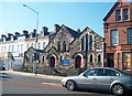
Mountpottinger Non-Subscribing Presbyterian Church, Castlereagh Street
This East Belfast congregation founded in 1862 and present building dates from 1875.
http://www.nspresbyterian.org/churches/church21/churchdetail.htm
Image: © Eric Jones
Taken: 21 May 2012
0.05 miles
3
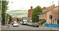
The Mountpottinger Road, Belfast
Built in the late 1870’s the Mountpottinger Road/Bothar Thulach Phoitinseir originally ran from the Albertbridge Road Image to Bridge End Image Road improvements mean that it now runs to the Mountpottinger Link/Lub Thulach Phoitinseir which, in turn reaches Bridge End via the Short Strand/An Trá Ghearr Image The now demolished (and formerly well-known) Prices of Mountpottinger was (approximately) on the right of the photo. The area has been extensively redeveloped.
Image: © Albert Bridge
Taken: 22 Jul 2009
0.05 miles
4
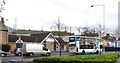
The Short Strand/Cluan Place interface from Mountpottinger Road
The houses whose roofs are visible in the image are in the Loyalist cul-de-sac of Cluan Place. Despite the height of the fences projectiles can be lobbed over them mainly in the form of masonry and bottles.
Image: © Eric Jones
Taken: 3 Nov 2014
0.05 miles
5
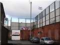
Entrance to the Loyalist Cluan Place in Inner East Belfast
Cluan Place is set at the interface with the Short Strand Estate. High peace walls separate the two communities.
Image: © Eric Jones
Taken: 3 Nov 2014
0.05 miles
6
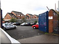
Modern apartments in Langtry Court
These are here viewed from Paulett Avenue
Image: © Eric Jones
Taken: 3 Nov 2014
0.06 miles
7
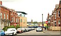
The Mount, Belfast (1)
The Mount runs in a loop off the Albertbridge Road Image It was built (approximately) on the site of Mount Pottinger, the home of Eldred Curwen Pottinger. This is the north western side looking towards the Albertbridge Road. Continue to Image
Image: © Albert Bridge
Taken: 22 Jul 2009
0.07 miles
8
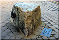
The Longbridge stone, Belfast
This stone is at the apex of Castlereagh Street and the Albertbridge Road. The plaque reads “The Longbridge stone Built 1831”. An alternative version is that it is the last relic of the Longbridge (1682 – 1841) which spanned the Lagan joining Ballymacarret to Belfast. It had 21 spans and was 2,562 feet long (or 840ft in another source). Replaced by the Queen’s Bridge Image
Image: © Albert Bridge
Taken: 14 Mar 2010
0.07 miles
10
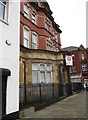
Former Ulster Bank building now for let as office space
This prestigious landmark building is located at the junction of Albertbridge Road and Cluan Place.
Image
Image: © Eric Jones
Taken: 3 Nov 2014
0.07 miles