IMAGES TAKEN NEAR TO
Beechleigh Park, LONDONDERRY, BT47 3QA

Introduction

This page details the photographs taken nearby to Beechleigh Park, BT47 3QA by members of the Geograph project.

The Geograph project started in 2005 with the aim of publishing, organising and preserving representative images for every square kilometre of Great Britain, Ireland and the Isle of Man.

There are currently over 7.5m images from over14,400 individuals and you can help contribute to the project by visiting https://www.geograph.org.uk

Image Map


Images are licensed for reuse under creativecommons.org/licenses/by-sa/2.0
Notes
  • Clicking on the map will re-center to the selected point.
  • The higher the marker number, the further away the image location is from the centre of the postcode.

Image Listing (10 Images Found)

Images are licensed for reuse under creativecommons.org/licenses/by-sa/2.0
Image
Details
Distance
1
Main Street, Eglinton
Main street in the village of Eglinton.
Image: © Rossographer Taken: 12 May 2010
0.10 miles
2
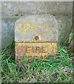
Bench Mark, Eglinton
Cut bench mark located on the front of a former bank in the village of Eglinton (see Image). The mark is 13.52 metres above MSL. See also http://www.geograph.org.uk/search.php?i=11037856 for many other examples I have found.
Image: © Rossographer Taken: 12 May 2010
0.11 miles
3
Fire hydrant marker post, Eglinton
Old fire hydrant marker on Main Street, Eglinton. Much rarer than the now commonly seen "H" signs.
Image: © Rossographer Taken: 12 May 2010
0.11 miles
4
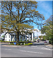
Eglinton village
The junction of Broadbridge Road with the main street in Eglinton. In the background is the bank and new flats.
Image: © Kay Atherton Taken: 4 Apr 2007
0.12 miles
5
Coolnafinny Road
It is located in the village of Eglington.
Image: © Kenneth Allen Taken: 26 Apr 2007
0.12 miles
6
Road junction, Eglinton
The junction of the Broadbridge Road (straight ahead and incorrectly shown as the Coolafinny Road on Google maps) and Main Street in the village of Eglinton
Image: © Rossographer Taken: 12 May 2010
0.13 miles
7
Field and gate, Eglinton
Field located on Main Street in the village of Eglinton.
Image: © Rossographer Taken: 12 May 2010
0.13 miles
8
Eglinton: postbox № BT47 89
This postbox, opposite the post office in the village centre, was painted gold in honour of Paralympian Jason Smyth's gold medal in the 100m and 200m events for blind athletes in the London 2012 games. Royal Mail painted a box gold in honour of all British medallists in the 2012 Olympics and Paralympics - although no one from Northern Ireland won gold for Great Britain, Jason Smyth did so representing the Republic of Ireland and he was born in Derry and lives here in Eglinton. See Image for a close-up of the plaque which can be seen on the right-hand side of the box.
Image: © Chris Downer Taken: 3 Aug 2016
0.15 miles
9
Eglinton: plaque on the gold postbox
Detail of the plaque on Image, explaining that it is in honour of Jason Smyth, who was born in Derry and resides in Eglinton, although his gold medal was won representing the Republic of Ireland. Smyth is a blind sprinter, although this is not the reason for the Braille translation on the plaque - all the plaques on gold postboxes have a Braille version.
Image: © Chris Downer Taken: 3 Aug 2016
0.15 miles
10
Woodvale Road Eglinton
As part of the Plantation of Ulster, James I had granted a large area of Faughanvale parish to the Grocers’ Company of London. The Grocers’ Company founded this plantation township, originally known as Muff, in 1619. In 1858 residents petitioned to change its name to avoid confusion with Muff in nearby Donegal. They chose Eglinton in honour of the 13th Earl, Lord Lieutenant of Ireland.
Image: © Rod Allday Taken: 26 Apr 2011
0.17 miles