IMAGES TAKEN NEAR TO
Lurganagoose Road, MAGHERAFELT, BT45 8GY

Introduction

This page details the photographs taken nearby to Lurganagoose Road, BT45 8GY by members of the Geograph project.

The Geograph project started in 2005 with the aim of publishing, organising and preserving representative images for every square kilometre of Great Britain, Ireland and the Isle of Man.

There are currently over 7.5m images from over14,400 individuals and you can help contribute to the project by visiting https://www.geograph.org.uk

Image Map


Images are licensed for reuse under creativecommons.org/licenses/by-sa/2.0
Notes
  • Clicking on the map will re-center to the selected point.
  • The higher the marker number, the further away the image location is from the centre of the postcode.

Image Listing (5 Images Found)

Images are licensed for reuse under creativecommons.org/licenses/by-sa/2.0
Image
Details
Distance
1
Knockcloghrim: the post office
The post office now occupies the narrow segment at the right-hand end of this building, but presumably it was originally within the shop that is long since closed. The village appears to be alternatively spelt with a 'u' - the branch name is Knockcloghrim but its postal address is Knockcloughrim. There has been a post office in the village since 1846.
Image: © Chris Downer Taken: 1 Aug 2016
0.01 miles
2
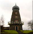
Knockloughrim Mill
Knockloughrim Windmill is a restored windmill which was in operation until the Great Wind of 1895 blew the sails off. It is an historic monument, one of three listed buildings in the village, and contains local history exhibits. The windmill is now owned by the Magherafelt and Knockloughrim Methodist Church and stands in the church grounds. (Google has it wrongly spelt as Knockcloghrim) More at http://en.wikipedia.org/wiki/Knockloughrim
Image: © Kenneth Allen Taken: 28 Sep 2007
0.10 miles
3
Knockloughrim Methodist Church
The plaque denotes that this building is relatively new as it is dated 1984. In the background a brick chimney from an old factory is still standing. (Google has it wrongly spelt as Knockcloghrim)
Image: © Kenneth Allen Taken: 28 Sep 2007
0.10 miles
4
Knockloughrim Windmill
Built between 1860 and 1875 by William Palmer, the sails were lost after a storm in the 1890's, and the onion top was put up instead. The land falls away behind the windmill.
Image: © Linda Bailey Taken: 21 Feb 2007
0.17 miles
5
Knockloughrim Orange Hall
The plaque indicates that it was built in 1908
Image: © Kenneth Allen Taken: 28 Sep 2007
0.21 miles