1
Carnlough, church
St. John's RC Church, on Bay Road: http://carnloughparish.com/locations/church/
Image: © Mike Faherty
Taken: 20 Jun 2018
0.01 miles
2
A2 Bay Road, Carnlough Road
Heading south
Image: © Kenneth Allen
Taken: 2 Jun 2010
0.03 miles
3
St John the Evangelist Church, 51 Bay Road, Carnlough, N. Ireland
This is the Catholic Parish Church and construction began in 1996. The church was officially opened on 7th December 1997. It was designed by Tracey Architects of Derry and built of soft red sandstone.
Image: © P L Chadwick
Taken: 8 Oct 2021
0.04 miles
4
The promenade at Carnlough
This large village has a Nationalist and Catholic majority (84%). This contrasts with 46% in Glenarm, its nearest neighbour to the south where Loyalist flags fly over the town.
Image: © Eric Jones
Taken: 13 Aug 2011
0.05 miles
5
View of Carnlough from the Ballyvaddy Road
Carnlough bathed in sunlight and the east Antrim coast with the Mull of Kintyre in Scotland in the distance. This area from western Scotland and including most of Co Antrim formed the ancient Kingdom Of Dalriada. The sea channel, far from being a barrier, was used as a highway by ancient peoples.
Image: © Robert Ashby
Taken: 4 Aug 2005
0.05 miles
6
Saint John's Primary School and Carnlough Community Nursery
It is located along Bay Road
Image: © Kenneth Allen
Taken: 2 Jun 2010
0.08 miles
7
Carnlough, school
St. John's Primary School and Community Nursery, on Bay Road: http://www.stjohnscarnlough.co.uk/
Image: © Mike Faherty
Taken: 20 Jun 2018
0.08 miles
8
St John's RC Church, Carnlough
It is located along Bay Road
Image: © Kenneth Allen
Taken: 2 Jun 2010
0.10 miles
9
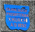
Plaque, Carnlough Presbyterian Church
It is located here
Image]
Image: © Kenneth Allen
Taken: 2 Jun 2010
0.10 miles
10
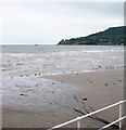
Stream discharging into Carnlough Bay
Image: © Eric Jones
Taken: 26 Sep 2013
0.10 miles


