View of Carnlough from the Ballyvaddy Road
Introduction
The photograph on this page of View of Carnlough from the Ballyvaddy Road by Robert Ashby as part of the Geograph project.
The Geograph project started in 2005 with the aim of publishing, organising and preserving representative images for every square kilometre of Great Britain, Ireland and the Isle of Man.

There are currently over 7.5m images from over 14,400 individuals and you can help contribute to the project by visiting https://www.geograph.org.uk
View of Carnlough from the Ballyvaddy Road
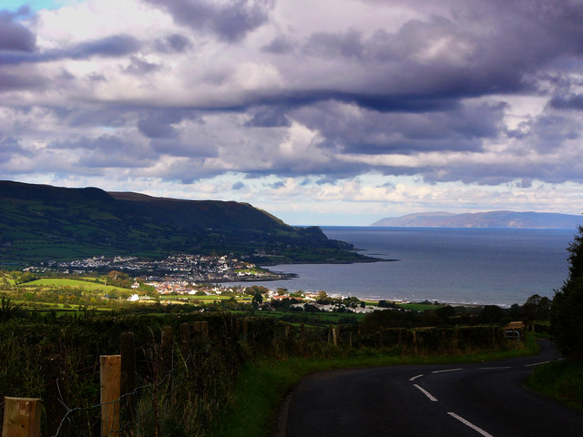
Image: © Robert Ashby Taken: 4 Aug 2005
Carnlough bathed in sunlight and the east Antrim coast with the Mull of Kintyre in Scotland in the distance. This area from western Scotland and including most of Co Antrim formed the ancient Kingdom Of Dalriada. The sea channel, far from being a barrier, was used as a highway by ancient peoples.
Images are licensed for reuse under creativecommons.org/licenses/by-sa/2.0
Image Location
Latitude
54.98861
Longitude
-5.994505