
IMAGES TAKEN NEAR TO
Upper Newtownards Road, BELFAST, BT4 3SF
Introduction
This page details the photographs taken nearby to Upper Newtownards Road, BT4 3SF by members of the Geograph project.
The Geograph project started in 2005 with the aim of publishing, organising and preserving representative images for every square kilometre of Great Britain, Ireland and the Isle of Man.

There are currently over 7.5m images from over14,400 individuals and you can help contribute to the project by visiting https://www.geograph.org.uk
Image Map
Images are licensed for reuse under creativecommons.org/licenses/by-sa/2.0
Notes
- Clicking on the map will re-center to the selected point.
- The higher the marker number, the further away the image location is from the centre of the postcode.
Image Listing (44 Images Found)
Images are licensed for reuse under creativecommons.org/licenses/by-sa/2.0
Image
Details
Distance
1
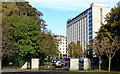
Dundonald House, Belfast (2)
See Image (January 2010). The view of Dundonald House from the other side of the Upper Newtownards Road. The entrance to the building (and other Government offices in the vicinity) has, for a long time, been by way of the Stoney Road. For an elevated view see Image (December 2010).
Image: © Albert Bridge
Taken: 1 Nov 2013
0.01 miles
2

Dundonald House
A view of part of Dundonald House, a huge office block housing several civil service departments on the edge of the Stormont Estate. The building, constructed in 1963, was one of the first large modern office blocks built in Northern Ireland.
Image: © Rossographer
Taken: 26 May 2009
0.03 miles
3
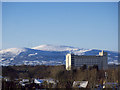
Dundonald House, Belfast
Another view of Dundonald House on the outskirts of Belfast. See also Image and Image Black Mountain and Divis Mountain Image can be seen in the distance behind, both covered in snow.
Image: © Rossographer
Taken: 19 Dec 2010
0.05 miles
4
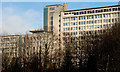
Dundonald House, Belfast
Looking like two buildings but really one, Dundonald House houses the Departments of Agriculture and Health. Completed in 1963. Architects Gibson and Taylor. For a better view see Image (November 2013).
Image: © Albert Bridge
Taken: 23 Jan 2010
0.05 miles
5
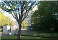
The entrance to Dundonald House
These are government buildings housing the Department of Health and Social Security and the Department of Agriculture.
Image: © Eric Jones
Taken: 21 May 2012
0.07 miles
6

Hotel sculpture, Belfast
At the entrance to the Hastings Stormont Hotel Image on the Upper Newtownards Road.
Image: © Albert Bridge
Taken: 23 Jan 2010
0.08 miles
7

Fungi, Belfast - November 2014(6)
See Image Another, less tightly-packed example, nearby.
Image: © Albert Bridge
Taken: 26 Nov 2014
0.09 miles
8
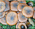
Fungi, Belfast - November 2014(5)
Part of a long growth (about 25 yards) of the same species of fungi, on the grass verge of the Upper Newtownards Road, opposite the Rosepark petrol station. For another example, nearby, see Image
Image: © Albert Bridge
Taken: 26 Nov 2014
0.09 miles
9
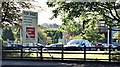
"For sale" sign, Rosepark House, Belfast (September 2015)
See Image A “for sale” sign facing the Upper Newtownards Road. The agents’ description includes “Offers invited in the region of £2,000,000 . . . . . . The site is bound by medium density residential housing to the South, East and West. A Maxol petrol filling station and Spar convenience store are located immediately adjacent to the site, also fronting Upper Newtownards Road. A two storey office building is situated in the middle of the site incorporating c.7,951 sq ft of accommodation.” This photograph appears as a matter of record only. I have no connection with the agents and cannot enter into correspondence.
Image: © Albert Bridge
Taken: 16 Sep 2015
0.09 miles
10
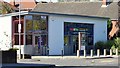
Nos 697-699 Upper Newtownards Road, Belfast (September 2015)
The former First Trust Bank now converted, after extensive work, to a veterinary surgery. This photograph appears as a matter of record only. I have no connection with the business.
Image: © Albert Bridge
Taken: 16 Sep 2015
0.10 miles