
IMAGES TAKEN NEAR TO
Upper Newtownards Road, BELFAST, BT4 3HB
Introduction
This page details the photographs taken nearby to Upper Newtownards Road, BT4 3HB by members of the Geograph project.
The Geograph project started in 2005 with the aim of publishing, organising and preserving representative images for every square kilometre of Great Britain, Ireland and the Isle of Man.

There are currently over 7.5m images from over14,400 individuals and you can help contribute to the project by visiting https://www.geograph.org.uk
Image Map
Images are licensed for reuse under creativecommons.org/licenses/by-sa/2.0
Notes
- Clicking on the map will re-center to the selected point.
- The higher the marker number, the further away the image location is from the centre of the postcode.
Image Listing (121 Images Found)
Images are licensed for reuse under creativecommons.org/licenses/by-sa/2.0
Image
Details
Distance
1
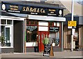
S D Bell's, Belfast
SD Bell has been importing tea and coffee since 1887. The coffee shop was originally in Ann Street Image but moved to the present site, close to the Knock crossroads, in 1973. A very popular spot with the locals. See also Image
Image: © Albert Bridge
Taken: 18 Feb 2008
0.00 miles
2
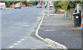
Upper Newtownards Road (EWAY), Knock, Belfast - September 2014(1)
The inward view, along the northern side of the Upper Newtownards Road, between Ormiston Park and SD Bell’s. EWAY work on this side is almost complete. It involved widening the road by reducing the width of the footpath and consequent alterations to the services. The effects are not too noticeable but can be appreciated by looking at the gap between the yellow lines and the kerb.
Image: © Albert Bridge
Taken: 21 Sep 2014
0.01 miles
3

Vacant shops, Knock, Belfast (2010-1)
Only one of the six shops in this row, close to the Knock crossroads, is occupied. With no agent’s board on display it looks as if the site might become apartments – after the recession.
Image: © Albert Bridge
Taken: 18 Jan 2010
0.02 miles
4

Newtownards Road
At the intersection with Knock Road.
Image: © Darrin Antrobus
Taken: 1 Feb 2013
0.03 miles
5
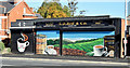
SD Bell's, Belfast (September 2014)
See Image (August 2009). There was much activity here during late July and early August as the business expanded into the former florist’s shop on the left. The original coffee shop was also refitted. The decorated shutter doors have changed too. This photograph appears as a matter of geographical and historical record only. I have no connection with the business.
Image: © Albert Bridge
Taken: 7 Sep 2014
0.03 miles
6
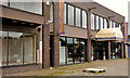
Former Gillespie & Wilson, Belfast (2012)
Long-established and well-known furniture shop at 411-419 Upper Newtownards Road, just closed.
Image: © Albert Bridge
Taken: 1 Jul 2012
0.03 miles
7
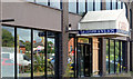
Former Gillespie & Wilson, Belfast (2013)
At the time of submission the Planning Service website was showing the application for planning permission at the “out to consultation” stage. In the meantime the premises remain vacant.
Image: © Albert Bridge
Taken: 12 Aug 2013
0.03 miles
8

Upper Newtownards Road (EWAY), Knock, Belfast - September 2014(2)
Preliminary work, on the southern side of the Upper Newtownards Road, opposite SD Bell’s here http://www.geograph.org.uk/snippet/9132. There are now signs warning of delays over the coming weeks. For the record this stretch has several businesses and is notable for the number of parked cars during working hours. In practice it’s usually reduced to one lane inward.
Image: © Albert Bridge
Taken: 21 Sep 2014
0.03 miles
9
![Bell & Co [2]](https://s1.geograph.org.uk/geophotos/05/49/77/5497793_13455325_120x120.jpg)
Bell & Co [2]
The front of the premises of S D Bell & Co Ltd, tea merchants located in Upper Newtownards Road.
Image: © Michael Dibb
Taken: 28 Jul 2017
0.03 miles
10

Road closure, Knock, Belfast (February 2018)
The Upper Newtownards Road at the Knock crossroads. Trafficwatch NI notes “East Belfast - in connection with the Belfast Rapid Transit project essential carriageway re-surfacing works on the A20 Upper Newtownards Road are scheduled to be carried out on five consecutive weekends from Saturday 27th January (and on the remaining dates as detailed below)
It is proposed that on each weekend the works will start at 19:00 on Saturday night and continue through until Sunday night / Monday morning. However, we would hope that the works will be completed earlier than Monday morning.
19:00 on Saturday 17th – 06:00 on Monday 19th February
19:00 on Saturday 24th – 06:00 on Monday 26th February
Plus another to be confirmed
During these times a diversion route will be in place from the Knock Road Junction and Comber Road Junction via Knock Road, Kings Road, Old Dundonald Road and Comber Road (and vice versa).
Within the area of the works local access will be maintained for residents and emergency vehicles only.”
Image: © Albert Bridge
Taken: 18 Feb 2018
0.03 miles