
IMAGES TAKEN NEAR TO
Knocknagoney Green, BELFAST, BT4 2QD
Introduction
This page details the photographs taken nearby to Knocknagoney Green, BT4 2QD by members of the Geograph project.
The Geograph project started in 2005 with the aim of publishing, organising and preserving representative images for every square kilometre of Great Britain, Ireland and the Isle of Man.

There are currently over 7.5m images from over14,400 individuals and you can help contribute to the project by visiting https://www.geograph.org.uk
Image Map
Images are licensed for reuse under creativecommons.org/licenses/by-sa/2.0
Notes
- Clicking on the map will re-center to the selected point.
- The higher the marker number, the further away the image location is from the centre of the postcode.
Image Listing (29 Images Found)
Images are licensed for reuse under creativecommons.org/licenses/by-sa/2.0
Image
Details
Distance
1
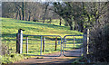
Gates, Knocknagoney, Belfast (February 2015)
Gates leading to fields and an agricultural lane on the eastern side of the Old Holywood Road.
Image: © Albert Bridge
Taken: 8 Feb 2015
0.02 miles
2
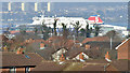
Rooftops, Knocknagoney, Belfast (February 2015)
The view from the Glenmachan Road on the western side of the Holywood Hills. The rooftops (foreground) are in the Knocknagoney estate. The ferry is the “Stena Superfast VIII” awaiting departure with the 11.30 to Cairnryan. The Rathcoole Flats Image and Image are in the background.
Image: © Albert Bridge
Taken: 8 Feb 2015
0.04 miles
3
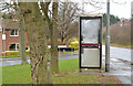
Telephone box, Knocknagoney, Belfast
A telephone box, at Knocknagoney Drive, beside the Old Holywood Road (right).
Image: © Albert Bridge
Taken: 12 Dec 2013
0.04 miles
4
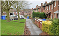
Knocknagoney Drive, Belfast
A street of redbrick terrace houses in the Knocknagoney estate, off the Old Holywood Road. The estate is built on the site of a house called Richmond Lodge – once the home of the Dunville distilling family Image Note: this was not the only “Richmond Lodge” in Belfast.
Image: © Albert Bridge
Taken: 12 Dec 2013
0.05 miles
5
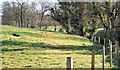
Fields and trees, Knocknagoney, Belfast - February 2015(1)
Fields and trees, on the eastern side of the Old Holywood Road, beyond here Image This is another of the places where a road marks the (current) limit of development.
Image: © Albert Bridge
Taken: 8 Feb 2015
0.06 miles
6
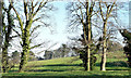
Fields and trees, Knocknagoney, Belfast - February 2015(2)
See Image The same area but seen from the south, on the Glenmachan Road.
Image: © Albert Bridge
Taken: 8 Feb 2015
0.06 miles
7

Garnerville Presbyterian church, Belfast
Presbyterian church on the Old Holywood Road which seems to date from 1950.
Image: © Albert Bridge
Taken: 13 Apr 2011
0.06 miles
8
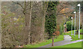
Path, Knocknagoney, Belfast
A path, behind Knocknagoney Drive, running from Knocknagoney Park Image into the Knocknagoney estate.
Image: © Albert Bridge
Taken: 12 Dec 2013
0.10 miles
9
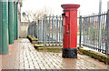
Pillar box, Knocknagoney, Belfast
An EIIR pillar box (BT4 569) at Knocknagoney Avenue.
Image: © Albert Bridge
Taken: 12 Dec 2013
0.14 miles
10
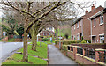
The Knocknagoney Road, Belfast
The Old Holywood Road end of a suburban road running from the Holywood Road. The houses on the right are part of the Knocknagoney estate – explained in Image
Image: © Albert Bridge
Taken: 12 Dec 2013
0.15 miles