IMAGES TAKEN NEAR TO
High Street, ANTRIM, BT41 4AP

Introduction

This page details the photographs taken nearby to High Street, BT41 4AP by members of the Geograph project.

The Geograph project started in 2005 with the aim of publishing, organising and preserving representative images for every square kilometre of Great Britain, Ireland and the Isle of Man.

There are currently over 7.5m images from over14,400 individuals and you can help contribute to the project by visiting https://www.geograph.org.uk

Image Map


Images are licensed for reuse under creativecommons.org/licenses/by-sa/2.0
Notes
  • Clicking on the map will re-center to the selected point.
  • The higher the marker number, the further away the image location is from the centre of the postcode.

Image Listing (127 Images Found)

Images are licensed for reuse under creativecommons.org/licenses/by-sa/2.0
  • ...
Image
Details
Distance
1
Market Square, Antrim
Close your eyes and imagine that you’re writing your dissertation for your doctorate in town planning. Now think of a (purely hypothetical) town which had a population under 3,000 in the mid-sixties. Then it became a “growth town” and today has a population of around 22,000. Part of a street is a continuation of High Street Image Two things happen – there is a ring road about the town centre Image, Image, Image and Image There is a shopping centre, just off the main streets with more car parking than the rest of the town combined, anchored by (cough, splutter) Tesco. Then a major new shopping centre opens outside the town Image and Image (close to the motorway). Then Tesco moves out of the old shopping centre and builds a stand-alone 24-hour establishment nearby. Oh and at the same time that former main street is now a cul-de-sac with enforced parking restrictions and no buses. Couldn’t happen?? Open your eyes. Taken at 12.53 on a Saturday. Nobody passed in front of the camera and I wasn’t in anybody’s way. Why not? Guess!
Image: © Albert Bridge Taken: 25 Sep 2010
0.00 miles
2
The Northern Bank, Antrim (1)
The branch of the Northern Bank at High Street, Antrim. The bank is due to renamed as Danske Bank Image next week removing a piece of local history. Old directories show that the Ulster Bank had a branch in Antrim since at least 1852 and the Belfast Bank since 1877. The Northern did not appear until much later. Image shows the name sign.
Image: © Albert Bridge Taken: 7 Nov 2012
0.02 miles
3
The Northern Bank, Antrim (2)
See Image The sign which will soon be a thing of the past.
Image: © Albert Bridge Taken: 7 Nov 2012
0.02 miles
4
High Street, Antrim
Once upon a time Antrim was a small country town with a population of about 2,500. Then, in the late 60’s/early 70’s it was designated as a “growth town” based on employment provided by the (now closed) British Enkalon factory. The population grew nearly tenfold but somebody forgot that more people needed more shops so High Street remains much the same as 45 years ago. Security barriers during the bombing campaign and the success of nearby Ballymena didn’t help much either. See also Image and Image
Image: © Albert Bridge Taken: 25 Jul 2010
0.03 miles
5
Postbox, Antrim
A rare example of the short lived 1970s square 'Type G' pillar box in Northern Ireland. This one (BT41 15) is located in High Street, Antrim.
Image: © Rossographer Taken: 26 Jun 2012
0.03 miles
6
Bridge over Six Mile Water, Antrim
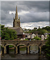
Bridge Street bridge over Six Mile Water, Antrim. The octagonal spire of All Saints Church can be seen in the background, built in 1816, it is the most prominent feature of the Antrim skyline.
Image: © Sue Adair Taken: 19 Nov 2008
0.04 miles
7
Former courthouse, Antrim
The north western side of the former Courthouse, in Market Square. Recently renovated and re-opened as a tourist office and arts centre, the building dates from 1726 Image The name of the architect is not recorded. For a completely different view (September 2012) see Image
Image: © Albert Bridge Taken: 25 Jul 2010
0.05 miles
8
Datestone, former courthouse, Antrim
The datestone on the corner of the former courthouse Image Note the missing “I” in “BULT” and the fancy “1” in the date.
Image: © Albert Bridge Taken: 25 Jul 2010
0.05 miles
9
Massereene Bridge, Antrim
In the foreground is the Massereene Bridge across the Sixmilewater. The bridge was built in 1708 by the Viscount Massereene as a gift to the people of Antrim. In the background is the spire of All Saints Church.
Image: © Rossographer Taken: 18 May 2009
0.05 miles
10
The Massereene Bridge, Antrim (4)
The view, upstream, showing the two arches (one of which is dry) at the northern end of the bridge.
Image: © Albert Bridge Taken: 7 Nov 2012
0.05 miles
  • ...