
IMAGES TAKEN NEAR TO
Larchfield, ANTRIM, BT41 2BQ
Introduction
This page details the photographs taken nearby to Larchfield, BT41 2BQ by members of the Geograph project.
The Geograph project started in 2005 with the aim of publishing, organising and preserving representative images for every square kilometre of Great Britain, Ireland and the Isle of Man.

There are currently over 7.5m images from over14,400 individuals and you can help contribute to the project by visiting https://www.geograph.org.uk
Image Map
Images are licensed for reuse under creativecommons.org/licenses/by-sa/2.0
Notes
- Clicking on the map will re-center to the selected point.
- The higher the marker number, the further away the image location is from the centre of the postcode.
Image Listing (6 Images Found)
Images are licensed for reuse under creativecommons.org/licenses/by-sa/2.0
Image
Details
Distance
1
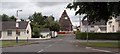
Ballycraigy Bonfire
Entrance to the Loyalist Ballycraigy housing estate in Antrim with the annual 11th of July bonfire ready to be lit.http://www.panoramio.com/user/574636
Image: © Shane Killen
Taken: 11 Jul 2007
0.19 miles
2
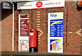
Pillar box, Muckamore post office
EIIR pillar box (BT41 28), at Muckamore post office, on the Belfast Road.
Image: © Albert Bridge
Taken: 19 Nov 2012
0.21 miles
3
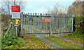
Islandbawn level crossing, Muckamore (1)
An accommodation level crossing (no XL 16) carrying a private road across the Belfast (left) – Londonderry/Portrush railway. The Belfast Road is immediately behind me. The gates are well back from the line. See also Image
Image: © Albert Bridge
Taken: 19 Nov 2012
0.23 miles
4
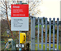
Islandbawn level crossing, Muckamore (2)
See Image The warning sign, telephone and official number.
Image: © Albert Bridge
Taken: 19 Nov 2012
0.23 miles
5
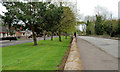
The Belfast Road, Muckamore
The Antrim – Templepatrick/Belfast road (right) as it passes the Ballycraigy estate. In the days before the M2 this was part of the main road from Belfast to an area stretching from Cookstown to Ballycastle. Very quiet now.
Image: © Albert Bridge
Taken: 14 Apr 2011
0.23 miles
6

Weed-spraying train, Muckamore
The CIE weed-spraying train, hauled by 169S, approaching the closed station (1906-1963) at Muckamore. At the time of the photograph the line was closed to all services and being worked as one section between Antrim and Bleach Green. The five level crossing gates were opened by the train’s guard. The line has since been re-opened and singled.
Image: © Albert Bridge
Taken: 6 Jun 1985
0.24 miles