
IMAGES TAKEN NEAR TO
The Grange, ANTRIM, BT41 1PF
Introduction
This page details the photographs taken nearby to The Grange, BT41 1PF by members of the Geograph project.
The Geograph project started in 2005 with the aim of publishing, organising and preserving representative images for every square kilometre of Great Britain, Ireland and the Isle of Man.

There are currently over 7.5m images from over14,400 individuals and you can help contribute to the project by visiting https://www.geograph.org.uk
Image Map
Images are licensed for reuse under creativecommons.org/licenses/by-sa/2.0
Notes
- Clicking on the map will re-center to the selected point.
- The higher the marker number, the further away the image location is from the centre of the postcode.
Image Listing (19 Images Found)
Images are licensed for reuse under creativecommons.org/licenses/by-sa/2.0
Image
Details
Distance
1
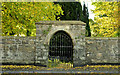
Old graveyard, Muckamore
The entrance, on the Belfast Road, to the old graveyard. The gate is padlocked but, as I later discovered, a key may be obtained locally. The keyholder’s name is available from the council http://www.antrim.gov.uk/.
Image: © Albert Bridge
Taken: 12 Oct 2012
0.09 miles
2
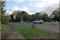
Antrim town
Busy roundabout at the junction of Belmont Road and Belfast Road in Antrim.
Image: © Robert Ashby
Taken: 12 Nov 2013
0.16 miles
3
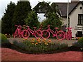
In the pink
Pink cycle-themed roundabout in Antrim to welcome the 2014 Giro d'Italia.
Image: © Robert Ashby
Taken: 10 May 2014
0.17 miles
4
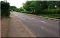
The Belfast Road, Antrim
The A522 Belfast Road south east of the centre of Antrim. This is the main route into Antrim from Templepatrick if you choose not to take the M2 motorway.
Image: © Rossographer
Taken: 19 May 2011
0.18 miles
5

Needham "Adaptable" grating cover, Muckamore
A Needham “Adaptable” grating cover, on the northern side of this railway bridge Image on the Oldstone Road.
Image: © Albert Bridge
Taken: 12 Oct 2012
0.18 miles
6
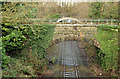
Railway, Moylena, Antrim
The railway to Bleach Green and Belfast (looking towards Antrim station) from the overbridge on the access road to Antrim Technology Park. The former bridge no 41 (now closed) is in the foreground. The overbridge on the Belmont Road Image is behind it. The line is due to receive an hourly service from Belfast (Gt Victoria Street) to Coleraine (between 06.05 and 22.10) from 6 January 2013.
Image: © Albert Bridge
Taken: 29 Dec 2012
0.19 miles
7
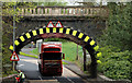
Railway bridge, Muckamore (3)
See Image The same bridge seen from the other side. It carries the Belfast (right) – Portrush/Londonderry railway across the Oldstone Road. Listed as HB20/13/008 where it is described as “Built in 1847, to carry the railway line of the Belfast and Ballymena Railway Company over the main road, to the designs of the company's engineer and architect, Charles Lanyon; contractor, William Dargan. The contract for the line was advertised in September 1845; contract awarded in October 1845; work started in November 1845; line opened in April 1848. Railway line replaced and parapets of bridge repaired in 2000.” Height restriction of 14ft3/4.2 metres.
Image: © Albert Bridge
Taken: 14 Apr 2011
0.19 miles
8
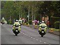
Police outriders
A team of police outriders signals the approach of the 2014 Giro d'Italia cycle race through Antrim.
Image: © Robert Ashby
Taken: 10 May 2014
0.19 miles
9
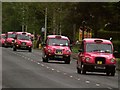
Pretty in pink
Taxis decked out in official Giro d'Italia pink act as support vehicles for the race as it comes through Antrim.
Image: © Robert Ashby
Taken: 10 May 2014
0.20 miles
10
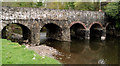
The Muckamore Bridge (1)
The listed bridge (HB20/13/007) carries the Oldstone Road across the Sixmilewater. Thought to date from 1780/1799. The List includes this description “Built mainly of blackstone rubble with rough stone voussoirs to segmental arches, rubble vaults, and the piers faced with triangular cutwaters of similar rubble, but the northern arches on the upstream side have been rebuilt with brick voussoirs and vaults, and their piers faced with lower triangular cutwaters of coursed basalt. On the west face the spandrels and parapet are of basalt rubble, in the same plane, but the top of the parapet has been newly rebuilt.” The view is downstream. See also Image
Image: © Albert Bridge
Taken: 14 Apr 2011
0.20 miles