
IMAGES TAKEN NEAR TO
Kilcairn, LARNE, BT40 3PJ
Introduction
This page details the photographs taken nearby to Kilcairn, BT40 3PJ by members of the Geograph project.
The Geograph project started in 2005 with the aim of publishing, organising and preserving representative images for every square kilometre of Great Britain, Ireland and the Isle of Man.

There are currently over 7.5m images from over14,400 individuals and you can help contribute to the project by visiting https://www.geograph.org.uk
Image Map
Images are licensed for reuse under creativecommons.org/licenses/by-sa/2.0
Notes
- Clicking on the map will re-center to the selected point.
- The higher the marker number, the further away the image location is from the centre of the postcode.
Image Listing (12 Images Found)
Images are licensed for reuse under creativecommons.org/licenses/by-sa/2.0
Image
Details
Distance
1
Ballystrudder, Islandmagee
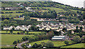
Previously just a crossroads on the road from Whitehead to Millbay and Ballylumford, Ballystrudder saw considerable development in the 1990’s. This view is from the lane at the side of Templecorran old church Ballycarry Image The Lough Road, from Ballycarry crossroads, is at bottom left.
Image: © Albert Bridge
Taken: 5 Jun 2012
0.09 miles
2
PAM rodding cover, Islandmagee
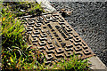
A rodding cover on the Low Road, Islandmagee Image bearing the name “PAM”. Although PAM Saint-Gobain is based in the USA this cover might have been cast here Image (before closure).
Image: © Albert Bridge
Taken: 12 Nov 2010
0.10 miles
3
Postbox BT40 21, Islandmagee
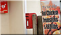
Post-mounted EIIR postbox (BT40 21) at Ballystrudder Image post office.
Image: © Albert Bridge
Taken: 27 Mar 2014
0.13 miles
4
Ballystrudder Road, Islandmagee
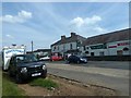
The Spar mini-market at the Ballystrudder crossroads on Islandmagee. Despite the name Islandmagee isn't an island but a peninsula firmly attached to the mainland at Blackhead. A smaller version of the Ards Peninsula in Co Down to the south.
Image: © Robert Ashby
Taken: 17 Jul 2013
0.13 miles
5
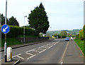
Middle Road, Islandmagee
Looking north along Middle Road from near the junction with Reids Road.
Image: © Rossographer
Taken: 11 May 2008
0.13 miles
6
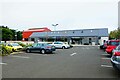
The Gobbins Visitor Centre, 68 Middle Road, Islandmagee, N. Ireland
The Gobbins Visitor Centre's website describes itself as "...forms part of Northern Irelands newest visitor attraction welcoming visitors from all over the world. The gift shop stocks a range of products including hand made crafts from within the Co. Antrim area, some of which are exclusive to The Gobbins." There is also a cafe and a large car park. Located off the B150 road.
The Islandmagee Community Centre is part of the complex.
Image: © P L Chadwick
Taken: 6 Oct 2021
0.14 miles
7
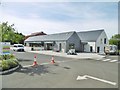
Ballystrudder, centre
Gobbins Visitor Centre, community centre and café, on Middle Road: http://www.craftni.org/craft-map-details/the-gobbins-visitor-centre
Image: © Mike Faherty
Taken: 25 Jun 2018
0.15 miles
8
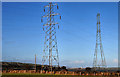
Pylons and power lines, Ballystrudder, Islandmagee (1)
Two pylons of different sizes and design close to the Low Road. The lines on the smaller one (left) lead towards Kilroot Image and Carrickfergus Image The lines on the other lead to this pylon Image
Image: © Albert Bridge
Taken: 12 Nov 2010
0.17 miles
9
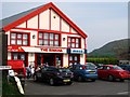
'The Rinkha', Islandmagee
Formerly a ballroom and restaurant, 'The Rinkha' is now a long established shop. Something of a general store / small supermarket it is famous for one item in particular - ice cream. People flock from near and far to sample the delights and on the sunny Sunday afternoon when this was taken the queues were constant.
Image: © Rossographer
Taken: 11 May 2008
0.17 miles
10
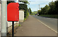
Letter box, Islandmagee
Post-mounted EIIR letter box, beside the Middle Road, at Ballystrudder Image I recorded it as BT40 3 although that number seems to be (or to have previously been) allocated to the postbox at the Co-op, Larne Image
Image: © Albert Bridge
Taken: 29 Aug 2012
0.18 miles