Ballystrudder, Islandmagee
Introduction
The photograph on this page of Ballystrudder, Islandmagee by Albert Bridge as part of the Geograph project.
The Geograph project started in 2005 with the aim of publishing, organising and preserving representative images for every square kilometre of Great Britain, Ireland and the Isle of Man.

There are currently over 7.5m images from over 14,400 individuals and you can help contribute to the project by visiting https://www.geograph.org.uk
Ballystrudder, Islandmagee
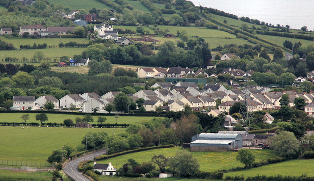
Image: © Albert Bridge Taken: 5 Jun 2012
Previously just a crossroads on the road from Whitehead to Millbay and Ballylumford, Ballystrudder saw considerable development in the 1990’s. This view is from the lane at the side of Templecorran old church Ballycarry Image The Lough Road, from Ballycarry crossroads, is at bottom left.
Images are licensed for reuse under creativecommons.org/licenses/by-sa/2.0
Image Location
Latitude
54.779694
Longitude
-5.709048