IMAGES TAKEN NEAR TO
Redlands, Coastguard Road, LARNE, BT40 1AX

Introduction

This page details the photographs taken nearby to Redlands, Coastguard Road, BT40 1AX by members of the Geograph project.

The Geograph project started in 2005 with the aim of publishing, organising and preserving representative images for every square kilometre of Great Britain, Ireland and the Isle of Man.

There are currently over 7.5m images from over14,400 individuals and you can help contribute to the project by visiting https://www.geograph.org.uk

Image Map


Images are licensed for reuse under creativecommons.org/licenses/by-sa/2.0
Notes
  • Clicking on the map will re-center to the selected point.
  • The higher the marker number, the further away the image location is from the centre of the postcode.

Image Listing (59 Images Found)

Images are licensed for reuse under creativecommons.org/licenses/by-sa/2.0
  • ...
Image
Details
Distance
1
Wreck, Larne
View from the edge of the Harbour Roundabout on the A8.
Image: © Richard Webb Taken: 18 Jul 2012
0.08 miles
2
Ship Street sign, Larne
Ship Street is a short street close to the harbour. The sign has an excellent view of the lough and the Harbour Highway.
Image: © Albert Bridge Taken: 14 Aug 2010
0.09 miles
3
Steel Stern
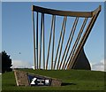
One of the first things that visitors see after they disembark from the Ferry in Larne is this large 'Steel Stern' sculpture.
Image: © Puffer Taken: 5 Jan 2012
0.09 miles
4
Welcome to Larne
The Harbour roundabout is the first sight of NI seen by passengers arriving off the ferries from Cairnryan, Troon and Fleetwood. “The Stern”, by Paul Hogarth, greets them. The Council’s website describes it thus: “Visitors arriving in Larne by sea through the Port of Larne are now welcomed by a new feature in the landscape. This “Steel Stern” sculpture has been placed on the Harbour Roundabout in recognition of the important links between the development of the port and the town of Larne. It represents the stern of a ship and provides a memorable feature that is unique to Larne and welcomes everyone on their arrival in Northern Ireland. “
Image: © Albert Bridge Taken: 14 Aug 2010
0.10 miles
5
Mulberry harbour, Larne
After WWII the Atlantic Steam Navigation Company started operating ro-ro ferry service from Larne to Preston using ex-naval LST’s (Landing Ship Tanks). The loading/discharge ramp was partly built from cascaded bits of the mulberry harbours used in the “D day” landings. A visitor to the site has contacted me with the following additional information “I remember very well several of these "Mulberry" pontoons being towed to Larne and used as foundations for extension of the harbour for the increase in shipping. Some were not used and the one you photographed is one of them”. The definitive answer.
Image: © Albert Bridge Taken: 14 Aug 2010
0.10 miles
6
Road sign, Larne harbour
A direction sign at the harbour gate, close to the harbour roundabout Image, at the end of the Olderfleet Road. The Cairnryan service still operates Image The Ardrossan service was transferred to Troon Image but has now been withdrawn, the Fleetwood service Image was withdrawn but has a de-facto replacement to Heysham Image and the Stranraer service transferred to Belfast Image but recently moved to Cairnryan Image
Image: © Albert Bridge Taken: 6 Oct 1995
0.11 miles
7
The Redlands, Larne (1)
Warehousing on the eastern side.
Image: © Albert Bridge Taken: 14 Aug 2010
0.11 miles
8
Coastguard station, Larne
Image: © Richard Webb Taken: 18 Jul 2012
0.15 miles
9
The Redlands, Larne (2)
A small scrapyard (which now accounts for the non-ferry trade from the harbour) and warehousing.
Image: © Albert Bridge Taken: 14 Aug 2010
0.16 miles
10
Ferry queue
Cars waiting to board the P&O ferry from Larne to Cairnryan.
Image: © James Allan Taken: 8 Oct 2011
0.17 miles
  • ...