IMAGES TAKEN NEAR TO
Drumboy Road, NEWRY, BT35 9JQ
Introduction
This page details the photographs taken nearby to Drumboy Road, BT35 9JQ by members of the Geograph project.
The Geograph project started in 2005 with the aim of publishing, organising and preserving representative images for every square kilometre of Great Britain, Ireland and the Isle of Man.

There are currently over 7.5m images from over14,400 individuals and you can help contribute to the project by visiting https://www.geograph.org.uk
Image Map
Images are licensed for reuse under creativecommons.org/licenses/by-sa/2.0
Notes
- Clicking on the map will re-center to the selected point.
- The higher the marker number, the further away the image location is from the centre of the postcode.
Image Listing (19 Images Found)
Images are licensed for reuse under creativecommons.org/licenses/by-sa/2.0
Image
Details
Distance
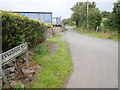
1
Pasture land on the North side of Drumboy Road
Image: © Eric Jones
Taken: 6 Sep 2019
0.06 miles
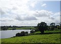
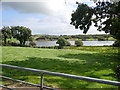
2
Grassy field on the northern slopes of Drumboy Lough
The image was taken from Drumboy Road.
Image: © Eric Jones
Taken: 6 Sep 2019
0.09 miles
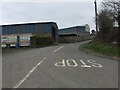
3
The southern end of the Annaghgad Road
The image was taken from the junction with the Drumboy Border road.
Image: © Eric Jones
Taken: 6 Sep 2019
0.11 miles
4
Annaghgad Road, Drumboy
Located to the south of the village of Cullaville, Drumboy is the southernmost townland in County Armagh and it borders County Monaghan in the Republic of Ireland.
Image: © Dean Molyneaux
Taken: 5 Apr 2015
0.11 miles
5
The Annaghgad Road junction on the Drumboy Road
The Drumboy Road swings south-eastwards to reach the Border at Keenoge
Image: © Eric Jones
Taken: 6 Sep 2019
0.13 miles
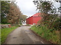
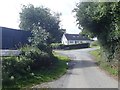
6
Farmhouse on the lower section of Drumboy Road
Image: © Eric Jones
Taken: 6 Sep 2019
0.16 miles
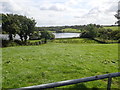
7
Border lake - Drumboy Lough
The territory of the Irish Republic projects north-westwards into the Drumboy Lough basin.
Image: © Eric Jones
Taken: 6 Sep 2019
0.16 miles
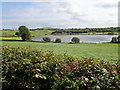
8

Drumboy Lough viewed from the Drumboy Road
Part of the southern shore of the lough is in the Irish Republic.
Image: © Eric Jones
Taken: 6 Sep 2019
0.16 miles