
IMAGES TAKEN NEAR TO
Bernish Avenue, NEWRY, BT35 8GA
Introduction
This page details the photographs taken nearby to Bernish Avenue, BT35 8GA by members of the Geograph project.
The Geograph project started in 2005 with the aim of publishing, organising and preserving representative images for every square kilometre of Great Britain, Ireland and the Isle of Man.

There are currently over 7.5m images from over14,400 individuals and you can help contribute to the project by visiting https://www.geograph.org.uk
Image Map
Images are licensed for reuse under creativecommons.org/licenses/by-sa/2.0
Notes
- Clicking on the map will re-center to the selected point.
- The higher the marker number, the further away the image location is from the centre of the postcode.
Image Listing (26 Images Found)
Images are licensed for reuse under creativecommons.org/licenses/by-sa/2.0
Image
Details
Distance
2
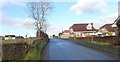
New estates at the southern end of the village of Cloughoge
The image was taken from the Park View section of the Newtown Road.
Image: © Eric Jones
Taken: 6 Feb 2019
0.09 miles
4
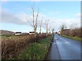
Approaching the 30mph speed restriction signs on the Park View section of Newtown Road
Image: © Eric Jones
Taken: 6 Feb 2019
0.11 miles
5
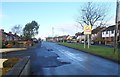
The north end of Newtown Road at Cloughoge
Image: © Eric Jones
Taken: 6 Feb 2019
0.15 miles
6
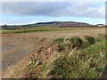
Development land on the South side of Cloughoge
The image was taken from the Ellisholding Road junction on the Newtown Road. Ribbon development is already well advanced along the Newtown Road. The hill in the background is Camlough Mountain.
Image: © Eric Jones
Taken: 6 Feb 2019
0.17 miles
7
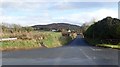
Ellisholding Road at its junction with Newtown Road, Cloughoge
Ellisholding Road gives direct access to the A1 at the Dublin Road intersection. It also provides access to Cloughoge's Mountain Road. The hill in the background of this image is Fathom Mountain, a part of the Ring of Gullion.
Image: © Eric Jones
Taken: 6 Feb 2019
0.19 miles
8
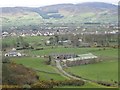
View South from Ballymacdermot Mountain
The two farms in the foreground are Carrickatlel and Heath Hall on Seavers Road. The village in the middle ground is Cloughoge on the B113. In the background is the northern flank of the Cooley Mountains. The border weaves its way across the slopes of the mountains. The slopes on the right are entirely in the Irish Republic's Co Louth, those on the left including Clontygora Forest, are in Northern Ireland's Co Armagh with the border running along the summits.
Image]
Image: © Eric Jones
Taken: 21 Mar 2019
0.19 miles
9
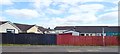
Houses in Carn Park, Cloghoge
In the foreground is the Cloghoge outward bus stop served by the No 43 Newry to Forkhill Ulsterbus service.
Image: © Eric Jones
Taken: 21 Jun 2018
0.20 miles
10
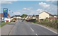
The B113 at Cloghoge (Cloughoge)
The B113 has the Cloghoge Retail Park on the left and the village of the right. Cloghoge has developed as an overspill village for nearby Newry.
Image: © Eric Jones
Taken: 16 May 2013
0.21 miles