View South from Ballymacdermot Mountain
Introduction
The photograph on this page of View South from Ballymacdermot Mountain by Eric Jones as part of the Geograph project.
The Geograph project started in 2005 with the aim of publishing, organising and preserving representative images for every square kilometre of Great Britain, Ireland and the Isle of Man.

There are currently over 7.5m images from over 14,400 individuals and you can help contribute to the project by visiting https://www.geograph.org.uk
View South from Ballymacdermot Mountain
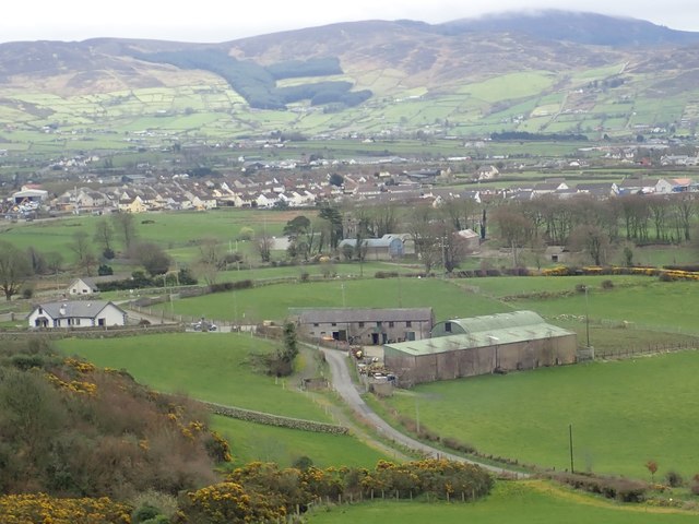
Image: © Eric Jones Taken: 21 Mar 2019
The two farms in the foreground are Carrickatlel and Heath Hall on Seavers Road. The village in the middle ground is Cloughoge on the B113. In the background is the northern flank of the Cooley Mountains. The border weaves its way across the slopes of the mountains. The slopes on the right are entirely in the Irish Republic's Co Louth, those on the left including Clontygora Forest, are in Northern Ireland's Co Armagh with the border running along the summits. Image]
Images are licensed for reuse under creativecommons.org/licenses/by-sa/2.0
Image Location
Latitude
54.141978
Longitude
-6.357488