
IMAGES TAKEN NEAR TO
Drumalane Park, NEWRY, BT35 8AU
Introduction
This page details the photographs taken nearby to Drumalane Park, BT35 8AU by members of the Geograph project.
The Geograph project started in 2005 with the aim of publishing, organising and preserving representative images for every square kilometre of Great Britain, Ireland and the Isle of Man.

There are currently over 7.5m images from over14,400 individuals and you can help contribute to the project by visiting https://www.geograph.org.uk
Image Map
Images are licensed for reuse under creativecommons.org/licenses/by-sa/2.0
Notes
- Clicking on the map will re-center to the selected point.
- The higher the marker number, the further away the image location is from the centre of the postcode.
Image Listing (53 Images Found)
Images are licensed for reuse under creativecommons.org/licenses/by-sa/2.0
Image
Details
Distance
1
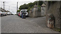
The Drumalane Road, Newry
Mostly residential road in Newry. The boundary stone on the right is described in Image
Image: © Rossographer
Taken: 6 May 2019
0.07 miles
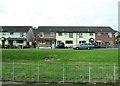
3
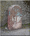
Boundary Stone and Bench Mark, Newry
An old boundary stone on the Drumalane Road in Newry. The writing is very worn, all I can make out is, I think, the word 'Newry'. It appears to mark the limits of the old municipal boundary and is marked on old OS maps as a boundary stone.
The stone also has a bench mark which has been levelled to 16.44 metres above MSL.
Image: © Rossographer
Taken: 6 May 2019
0.08 miles
4
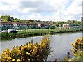
Artie Green Dromalane Soccer Pitch, Newry
The teams playing here are members of the Carnbane (Newry and Mourne) League.
Image: © Eric Jones
Taken: 12 May 2018
0.09 miles
5
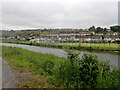
Drumalane Park Playing Fields, Newry
The image was taken across the Newry Canal from the Greenway.
Image: © Eric Jones
Taken: 9 Jun 2021
0.10 miles
6
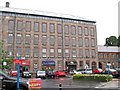
Drumalane Mill at the Quays Shopping Centre
This mill was converted into a retail centre as part of the 3rd phase of development at the Quays
http://www.thequays.co.uk/directory/phase3drumalanemill/index.asp
Image: © Eric Jones
Taken: 10 Jul 2010
0.11 miles
7
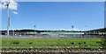
Pairc Esler GAA Stadium from the Newry Greenway
This is a 20,000 seater stadium. It is the home of the Down Gaelic football and hurling teams and of the local Shamrocks GAA club.
Image: © Eric Jones
Taken: 12 May 2018
0.13 miles
8
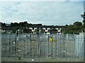
Electricity Sub-Station overlooking the Albert Basin
The houses behind are in Drumalane Park.
Image: © Eric Jones
Taken: 20 Sep 2016
0.14 miles
9
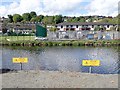
Hazards on the Newry Ship Canal
The risk of drowning in the deep waters of the canal is not the only hazard for users of the Newry Greenway. The yellow signs warn of the danger of high voltage cables on the bed of the canal and along its banks. An Electricity Sub Station stands on the opposite bank of the canal.
Image: © Eric Jones
Taken: 12 May 2018
0.15 miles
10
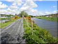
View North along the Newry Greenway
The Newry Ship Canal is on the left and the Newry River on the right.
Image: © Eric Jones
Taken: 12 May 2018
0.16 miles