Boundary Stone and Bench Mark, Newry
Introduction
The photograph on this page of Boundary Stone and Bench Mark, Newry by Rossographer as part of the Geograph project.
The Geograph project started in 2005 with the aim of publishing, organising and preserving representative images for every square kilometre of Great Britain, Ireland and the Isle of Man.

There are currently over 7.5m images from over 14,400 individuals and you can help contribute to the project by visiting https://www.geograph.org.uk
Boundary Stone and Bench Mark, Newry
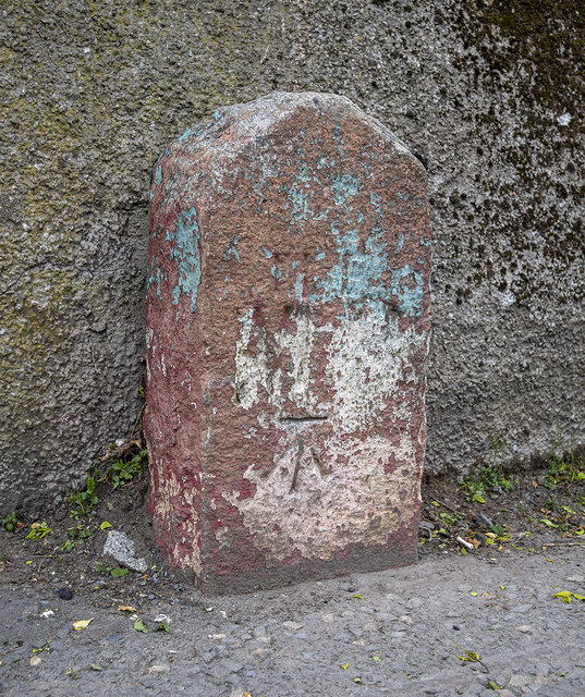
Image: © Rossographer Taken: 6 May 2019
An old boundary stone on the Drumalane Road in Newry. The writing is very worn, all I can make out is, I think, the word 'Newry'. It appears to mark the limits of the old municipal boundary and is marked on old OS maps as a boundary stone. The stone also has a bench mark which has been levelled to 16.44 metres above MSL.
Images are licensed for reuse under creativecommons.org/licenses/by-sa/2.0
Image Location
Latitude
54.164449
Longitude
-6.341699