
IMAGES TAKEN NEAR TO
Ballynagappoge Road, NEWRY, BT34 5HH
Introduction
This page details the photographs taken nearby to Ballynagappoge Road, BT34 5HH by members of the Geograph project.
The Geograph project started in 2005 with the aim of publishing, organising and preserving representative images for every square kilometre of Great Britain, Ireland and the Isle of Man.

There are currently over 7.5m images from over14,400 individuals and you can help contribute to the project by visiting https://www.geograph.org.uk
Image Map
Images are licensed for reuse under creativecommons.org/licenses/by-sa/2.0
Notes
- Clicking on the map will re-center to the selected point.
- The higher the marker number, the further away the image location is from the centre of the postcode.
Image Listing (40 Images Found)
Images are licensed for reuse under creativecommons.org/licenses/by-sa/2.0
Image
Details
Distance
1

Landscape north of the Castlewellan Road at Lenish Bridge
Image: © Eric Jones
Taken: 2 Jul 2010
0.00 miles
2

Farmsteads on a drumlin east of the Ballynagappoge Road
Image: © Eric Jones
Taken: 9 Oct 2018
0.03 miles
3

Homesteads on a drumlin off the Ballynagappoge Road
These occupy a dry site above the flood plain of the Bann. The image was taken from the A25.
Image: © Eric Jones
Taken: 12 May 2018
0.05 miles
4

Farmstead off the minor Ballynagappoge Road
The farmstead overlooks the Bann Valley.
Image: © Eric Jones
Taken: 5 Feb 2018
0.06 miles
5

Homesteads on the Ballynagappoge Road
The image was taken from the A25 (Castlewellan Road).
Image: © Eric Jones
Taken: 5 Feb 2018
0.06 miles
6
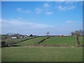
Drumlins north of the A25 (Castlewellan Road)
Image: © Eric Jones
Taken: 2 Mar 2011
0.07 miles
7

A clachan of farmsteads on a private road leading from the Ballynagappoge Road
Image: © Eric Jones
Taken: 9 Oct 2018
0.07 miles
8
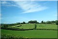
Sheep pasturage on the north side of the A25 (Castlewellan Road)
This is an area of well formed drumlins in the Upper Bann Valley.
Image: © Eric Jones
Taken: 25 Sep 2017
0.10 miles
9

Rural settlement in the Townland of Ballynagappoge
Image: © Eric Jones
Taken: 24 Mar 2012
0.11 miles
10
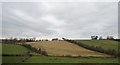
Hedged fields on a drumlin on the east side of the Upper Bann River
The image was taken from the A25
Image: © Eric Jones
Taken: 5 Feb 2018
0.12 miles