IMAGES TAKEN NEAR TO
Cavan Road, NEWRY, BT34 5EG
Introduction
This page details the photographs taken nearby to Cavan Road, BT34 5EG by members of the Geograph project.
The Geograph project started in 2005 with the aim of publishing, organising and preserving representative images for every square kilometre of Great Britain, Ireland and the Isle of Man.

There are currently over 7.5m images from over14,400 individuals and you can help contribute to the project by visiting https://www.geograph.org.uk
Image Map
Images are licensed for reuse under creativecommons.org/licenses/by-sa/2.0
Notes
- Clicking on the map will re-center to the selected point.
- The higher the marker number, the further away the image location is from the centre of the postcode.
Image Listing (43 Images Found)
Images are licensed for reuse under creativecommons.org/licenses/by-sa/2.0
Image
Details
Distance
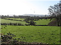
2
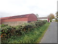
Undulating farmland east of the Cavan Road
Image: © Eric Jones
Taken: 5 Nov 2011
0.06 miles
4
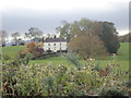
Georgian Villa off the Cavan Road
This stands on the northern slope of Cavan Hill.
Image: © Eric Jones
Taken: 9 Oct 2018
0.10 miles
5
Marker stone on the Townland Border between Cavan TD and Drumnascamph TD
Townlands are small geographical units dating back to the Gaelic Period. The 2014 Irish Place Name gazetteer lists the names of 61,098 townlands. Irish folk, especially in rural areas, still have strong loyalties to their native townland.
Image: © Eric Jones
Taken: 9 Oct 2018
0.11 miles
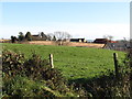
6
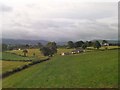
Countryside between the Castlewellan Road and Cavan Road
The bungalow in the middle ground is of recent build.
Image: © Eric Jones
Taken: 17 Jul 2010
0.11 miles
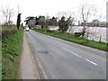
7
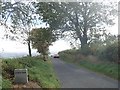
Cavan Road at the junction with Rathfriland Road
Image: © Eric Jones
Taken: 10 Jul 2010
0.13 miles
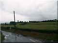
9
The A25 (Castlewellan Road) west of the junction with Moneygore Road
Image: © Eric Jones
Taken: 4 May 2013
0.15 miles
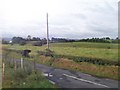
10
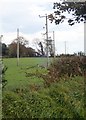
A 11kV line feeding a local line above the Cavan Road
Image: © Eric Jones
Taken: 9 Oct 2018
0.16 miles