
IMAGES TAKEN NEAR TO
Longstone Road, NEWRY, BT34 4UT
Introduction
This page details the photographs taken nearby to Longstone Road, BT34 4UT by members of the Geograph project.
The Geograph project started in 2005 with the aim of publishing, organising and preserving representative images for every square kilometre of Great Britain, Ireland and the Isle of Man.

There are currently over 7.5m images from over14,400 individuals and you can help contribute to the project by visiting https://www.geograph.org.uk
Image Map
Images are licensed for reuse under creativecommons.org/licenses/by-sa/2.0
Notes
- Clicking on the map will re-center to the selected point.
- The higher the marker number, the further away the image location is from the centre of the postcode.
Image Listing (19 Images Found)
Images are licensed for reuse under creativecommons.org/licenses/by-sa/2.0
Image
Details
Distance
1

Mourne Blackface Sheep north of Longstone Road
Though hardy, some Mourne farmers consider the Mourne Blackface with their single off-spring as being uneconomic and have looked to other breeds. One of these is the Lleyn breed from North Wales. But in terms of visual appeal the Mourne Blackface far outshines the Lleyn.
Image: © Eric Jones
Taken: 16 Mar 2011
0.02 miles
2
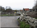
Derelict farm buildings and a cow on the Longstone Road
Image: © Eric Jones
Taken: 16 Mar 2011
0.03 miles
3
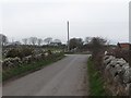
The junction of Grove Road and Longstone Road
Image: © Eric Jones
Taken: 16 Mar 2011
0.05 miles
4
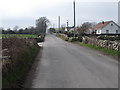
The Longstone Road at the junction with Grove Road
This view is taken in a westerly direction.
Image: © Eric Jones
Taken: 16 Mar 2011
0.05 miles
5
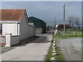
Farm access lane off Longstone Road
This lane provides access to a number of units.
Image: © Eric Jones
Taken: 16 Mar 2011
0.09 miles
6
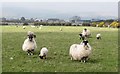
Blackface Mourne Sheep in a field alongside Oldtown Road
Houses on Oldtown Road and Oldtown Lane can be seen in the background. In summer the sheep are grazed on the uplands.
http://www.bbc.co.uk/programmes/p00c7rc2
Image: © Eric Jones
Taken: 16 Mar 2011
0.10 miles
7
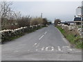
Oldtown Road from the crossroads
Oldtown Road links with Head Road which runs parallel with the southern flank of the Mournes.
Image: © Eric Jones
Taken: 16 Mar 2011
0.12 miles
8

Cottage at the northern end of Grove Road
Last time I passed this way, some six years ago, there was a friendly wee collie at the gate. He was not there this time. The junction with Longstone Road - in J3520 - can be seen in the background.
Image: © Eric Jones
Taken: 16 Mar 2011
0.12 miles
9
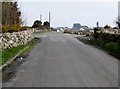
The eastern end of Longstone Road
Longstone Road ends at a crossroads. The continuation eastwards is known as Major's Hill. The two other roads forming the crossroads are, on the left, Oldtown Road and, on the right, Moneydarragh Road.
Image: © Eric Jones
Taken: 16 Mar 2011
0.13 miles
10
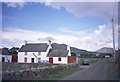
Cottage in Grove Road, Annalong
A typical Mournes coastal plain smallholding with, in the background, Slieve Binnian (left) and Slievelamagan (right). The family has a friendly wee collie which stands at the gate waiting to greet passers-by.
Image: © Eric Jones
Taken: 10 May 2005
0.13 miles