
IMAGES TAKEN NEAR TO
Newtown Row, NEWRY, BT34 3DG
Introduction
This page details the photographs taken nearby to Newtown Row, BT34 3DG by members of the Geograph project.
The Geograph project started in 2005 with the aim of publishing, organising and preserving representative images for every square kilometre of Great Britain, Ireland and the Isle of Man.

There are currently over 7.5m images from over14,400 individuals and you can help contribute to the project by visiting https://www.geograph.org.uk
Image Map
Images are licensed for reuse under creativecommons.org/licenses/by-sa/2.0
Notes
- Clicking on the map will re-center to the selected point.
- The higher the marker number, the further away the image location is from the centre of the postcode.
Image Listing (27 Images Found)
Images are licensed for reuse under creativecommons.org/licenses/by-sa/2.0
Image
Details
Distance
1
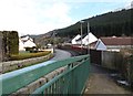
View eastwards along Newtown Road from the footbridge over the Kilbroney River
This metal footbridge has been built next to the road bridge.
Image: © Eric Jones
Taken: 12 Mar 2013
0.01 miles

3
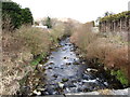
The Kilbroney River north of Newtown Road Bridge
Image: © Eric Jones
Taken: 12 Mar 2013
0.04 miles
4

The Newtown Road bridges at Rostrevor
With the outward spread of the village and the increase in road traffic it has become necessary to construct a footbridge along side the narrow road bridge.
Image: © Eric Jones
Taken: 12 Mar 2013
0.05 miles
5

Farmland between Pinewood Road and the Rostrevor Forest
Image: © Eric Jones
Taken: 12 Mar 2013
0.06 miles
6
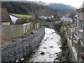
Flood defences below the Newtown Road Bridge
Anti-erosion measures have been taken below the bridge where the river runs through modern housing estates.
Image: © Eric Jones
Taken: 12 Mar 2013
0.06 miles
7

The fault-guided Kilbroney valley behind Rostrevor
The image was taken from the R173 south of Omeath. The Carlingford Lough in the foreground is also fault-guided.
Image: © Eric Jones
Taken: 21 Aug 2012
0.07 miles
8
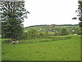
Rath at Rostrevor
A rath was an early medieval settlement in Ireland, fortified by earth banks. http://en.wikipedia.org/wiki/Ringfort
Image: © Oliver Dixon
Taken: 12 May 2007
0.08 miles
9
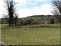
A rath on the outskirts of Rostrevor
A rath is an earthworksenclosing a circular enclosure which was used as a dwelling and stronghold in former times. This rath overlooks the Kilbroney River.
Image: © Eric Jones
Taken: 12 Mar 2013
0.09 miles
10
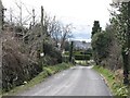
Newtown Road descending into Rostrevor
Carlingford Lough and the Cooley Hills can be seen in the background.
Image: © Eric Jones
Taken: 12 Mar 2013
0.11 miles