
IMAGES TAKEN NEAR TO
Greenan Lough Road, NEWRY, BT34 2QD
Introduction
This page details the photographs taken nearby to Greenan Lough Road, BT34 2QD by members of the Geograph project.
The Geograph project started in 2005 with the aim of publishing, organising and preserving representative images for every square kilometre of Great Britain, Ireland and the Isle of Man.

There are currently over 7.5m images from over14,400 individuals and you can help contribute to the project by visiting https://www.geograph.org.uk
Image Map
Images are licensed for reuse under creativecommons.org/licenses/by-sa/2.0
Notes
- Clicking on the map will re-center to the selected point.
- The higher the marker number, the further away the image location is from the centre of the postcode.
Image Listing (15 Images Found)
Images are licensed for reuse under creativecommons.org/licenses/by-sa/2.0
Image
Details
Distance
1
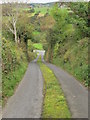
Steep section of Mullavat Road
This minor road climbs over the ridge to join the Greenan Road.
Image: © Eric Jones
Taken: 14 Sep 2011
0.07 miles
2
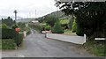
The northern end of Grinan Lough Road
This road is marked on OS maps as Greenan Lough Road.
Image: © Eric Jones
Taken: 14 Sep 2011
0.11 miles
3
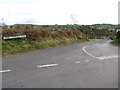
The western end of the Lower Corrags Road
The road name differs between the road name plate and the map. OSNI maps use the Carrogs version.
Image: © Eric Jones
Taken: 7 Nov 2016
0.12 miles
4
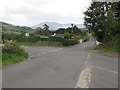
Greenan Lough Road from the crossroads
The crossroads is the meeting place of Betty Hill Road, Greenan Lough Road, Chapel Road and Lower Carrogs Road. The hills in the background are part of the Repulbic's Cooley Mountains.
Image: © Eric Jones
Taken: 14 Sep 2011
0.14 miles
5
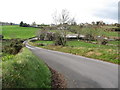
Pig units at Curly Brae Farm
This farm is located in the Grinan Valley.
Image: © Eric Jones
Taken: 7 Nov 2016
0.14 miles
6
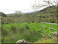
The valley floor north of Greenan Lough
This view is taken from Lower Carrogs Road.
Image: © Eric Jones
Taken: 14 Sep 2011
0.14 miles
7
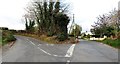
The junction of Chapel Road and Betty's Hill Road
These are part of the cross roads with Greenan Road and Lower Carrogs Road. The buildings beyond, on Betty's Hill Road are those of the Ballyholland Primary School.
Image: © Eric Jones
Taken: 7 Nov 2016
0.15 miles
8
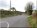
Cross roads on the Grinan Lough Road
The image, taken from the western end of Lower Corrags Road, shows Chapel Road ahead. The road to the right is Betty's Hill Road.
Image: © Eric Jones
Taken: 7 Nov 2016
0.15 miles
9
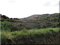
The marshy floor of the Grinan Valley
This is an area of hills and valleys underlain by rocks of Silurian and Ordovician age.
Image: © Eric Jones
Taken: 7 Nov 2016
0.16 miles
10
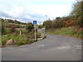
Cul-de-sac leading north from the Lower Corrigs Road
Image: © Eric Jones
Taken: 7 Nov 2016
0.21 miles