IMAGES TAKEN NEAR TO
Upper Water Street, NEWRY, BT34 1DJ
Introduction
This page details the photographs taken nearby to Upper Water Street, BT34 1DJ by members of the Geograph project.
The Geograph project started in 2005 with the aim of publishing, organising and preserving representative images for every square kilometre of Great Britain, Ireland and the Isle of Man.

There are currently over 7.5m images from over14,400 individuals and you can help contribute to the project by visiting https://www.geograph.org.uk
Image Map
Images are licensed for reuse under creativecommons.org/licenses/by-sa/2.0
Notes
- Clicking on the map will re-center to the selected point.
- The higher the marker number, the further away the image location is from the centre of the postcode.
Image Listing (650 Images Found)
Images are licensed for reuse under creativecommons.org/licenses/by-sa/2.0
Image
Details
Distance
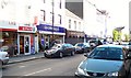
1
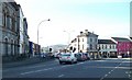
The junction of Abbey Way (A2) and Kildare Street (A27)
The A2 leads south in the direction of The Point and Rostrevor.
Image: © Eric Jones
Taken: 22 Aug 2009
0.01 miles

3
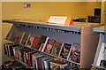
Polish section at Newry Library
The local library at Newry has substantial collections of books in the various Eastern European languages. It reflects the growth of Polish, Latvian, Lithuanian and Estonian communities in the area.
Image: © Eric Jones
Taken: 10 Dec 2010
0.02 miles
4
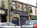
St John Bosco Social Club, Abbey Way, Newry
This is a GAA affiliated club.
Image: © Eric Jones
Taken: 30 Jun 2011
0.02 miles
7
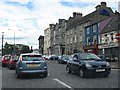
Traffic in Abbey Way, Newry
Abbey Way is the inner relief road of Newry and is part of the A2.
Image: © Eric Jones
Taken: 30 Jun 2011
0.03 miles
8
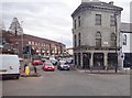
The junction of Upper Water Street/Abbey Way and Kildare Street, Newry
Upper Water Street and Abbey Way forms an inner by-pass for traffic moving in the city centre.
Image: © Eric Jones
Taken: 13 Mar 2018
0.03 miles
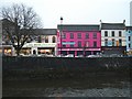
10
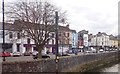
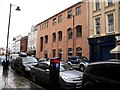
Buildings in Kildare Street viewed from Sugar Island Bridge
The river in the foreground is the Clanrye or Newry River.
Image: © Eric Jones
Taken: 13 Mar 2018
0.03 miles