IMAGES TAKEN NEAR TO
Clyde Court, NEWCASTLE, BT33 0FE
Introduction
This page details the photographs taken nearby to Clyde Court, BT33 0FE by members of the Geograph project.
The Geograph project started in 2005 with the aim of publishing, organising and preserving representative images for every square kilometre of Great Britain, Ireland and the Isle of Man.

There are currently over 7.5m images from over14,400 individuals and you can help contribute to the project by visiting https://www.geograph.org.uk
Image Map
Images are licensed for reuse under creativecommons.org/licenses/by-sa/2.0
Notes
- Clicking on the map will re-center to the selected point.
- The higher the marker number, the further away the image location is from the centre of the postcode.
Image Listing (1366 Images Found)
Images are licensed for reuse under creativecommons.org/licenses/by-sa/2.0
Image
Details
Distance
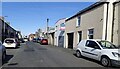
1
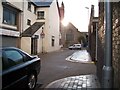
Donard Place
This lane links Downs Street with Main Street. The sun declines behind the Presbyterian church.
Image: © Eric Jones
Taken: 20 Aug 2009
0.01 miles
2
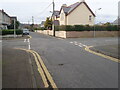
The northern limb of Bryansford Gardens
The image was taken across the intersecting Valentia Place.
Image: © Eric Jones
Taken: 23 Feb 2023
0.01 miles
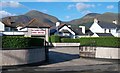
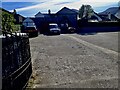
4
The Shirley Fullerton Memorial Hall in Bryansford Avenue
Image: © Eric Jones
Taken: 28 May 2010
0.02 miles
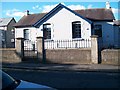
5
View NNE along Valentia Place from the direction of the Newcastle Fire Station
Valentia Place runs parallel with Main Street to join Bryansford Avenue.
Image: © Eric Jones
Taken: 27 Mar 2023
0.03 miles
6
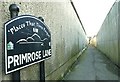
Primrose Lane, Newcastle
A lane running off the Shimna Road and recently one of the subjects of a scheme launched by the Chamber of Commerce as part of “The Places that Time Forgot” project.
Image: © Albert Bridge
Taken: 24 Jan 2009
0.03 miles
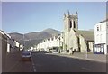
7
The rear of Newcastle's Presbyterian Church
The image was taken from the junction of Valentia Place and Bryansford Gardens.
Image: © Eric Jones
Taken: 23 Feb 2023
0.03 miles
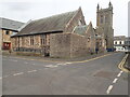
8
The Presbyterian Church, Newcastle
This nineteenth century church occupies a prominent position on Main Street, the town's commercial heart. The high peak in the background is Slieve Donard.
Image: © Eric Jones
Taken: 5 May 2004
0.03 miles
9
M I Sawey & Sons, Funeral Directors on Bryansford Avenue, Newcastle
This firm was established in 1929.
Image: © Eric Jones
Taken: 27 Mar 2023
0.04 miles
10
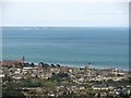
The centre of the town of Newcastle from Curraghard Mountain
Easily recognised land marks are from left to right: the Slieve Donard Hotel, the tower of Lidl store (formerly Newcastle Railway Station), the parasol roof of the Catholic church and the tower of the Presbyterian church. In the background right are St John's Point with its famous lighthouse and the hills of the Isle of Man.
Image: © Eric Jones
Taken: 5 May 2012
0.04 miles