The centre of the town of Newcastle from Curraghard Mountain
Introduction
The photograph on this page of The centre of the town of Newcastle from Curraghard Mountain by Eric Jones as part of the Geograph project.
The Geograph project started in 2005 with the aim of publishing, organising and preserving representative images for every square kilometre of Great Britain, Ireland and the Isle of Man.

There are currently over 7.5m images from over 14,400 individuals and you can help contribute to the project by visiting https://www.geograph.org.uk
The centre of the town of Newcastle from Curraghard Mountain
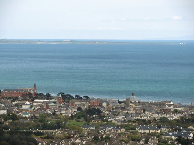
Image: © Eric Jones Taken: 5 May 2012
Easily recognised land marks are from left to right: the Slieve Donard Hotel, the tower of Lidl store (formerly Newcastle Railway Station), the parasol roof of the Catholic church and the tower of the Presbyterian church. In the background right are St John's Point with its famous lighthouse and the hills of the Isle of Man.
Images are licensed for reuse under creativecommons.org/licenses/by-sa/2.0
Image Location
Latitude
54.214046
Longitude
-5.890732