1
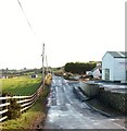
View south along Burrenreagh Road near Kane Heating Depot
Image: © Eric Jones
Taken: 12 Dec 2010
0.10 miles
2
Derelict cottage on the Burrenreagh Road
Image: © Eric Jones
Taken: 12 Dec 2010
0.11 miles
3
The entrance to the Rock Lane path on Burrenreagh Road
This path links Burrenreagh Road and Burren Road.
Image: © Eric Jones
Taken: 12 Dec 2010
0.13 miles
4
The Burrenreagh Mass Rock
In the Penal Times, when Catholic worship was forbidden, itinerant priests used to celebrate masses in the open air in out of the way places where the danger of being arrested by the agents of the Crown was less. One such place was The Rock between Castlewellan and Kilcoo.
https://en.wikipedia.org/wiki/Mass_rock
Image: © Eric Jones
Taken: 29 May 2016
0.14 miles
5
The eastern entrance to the Caskell Lane Footpath at Burrenreagh
This path leads westwards from the Burrenreagh Road to the Burren Road. The hill in the background, across the Dublin Road, is Ballymagreehan Hill.
Image: © Eric Jones
Taken: 12 Dec 2010
0.18 miles
6
Burrenreagh Road from the A25
Image: © Eric Jones
Taken: 14 Apr 2012
0.19 miles
7
View NNW from Cashel Lane
The view extends across the A25 corridor to the hills beyond.
Image: © Eric Jones
Taken: 7 Jul 2016
0.21 miles
8
A Wee Dog's Life is Full of Disappointments
He came out of one of the houses on the Burrenreagh Road thinking he had found a playmate. All he asked for was for me to throw the bottle that lay by the pole. I could not ignore the sad little mite. Once, I had done that he went home happy carrying the bottle in his mouth.
Image: © Eric Jones
Taken: 12 Dec 2010
0.22 miles
9
Rough pasture on the east side of Cashel Lane
This contrasts with the improved pasture and hay meadows which characterise most of this area.
Image: © Eric Jones
Taken: 7 Jul 2016
0.23 miles
10
Wire fenced topped dry stone walls on Cashel Lane
Wire fences surmounting stone walls are common on land grazed by sheep. Unlike cattle, sheep are adept at climbing over stone walls and in this instance the open ended Cashel Lane would provide easy access on to motor roads for any escapees.
Image: © Eric Jones
Taken: 7 Jul 2016
0.24 miles


