IMAGES TAKEN NEAR TO
Killyleagh Road, DOWNPATRICK, BT30 9BX

Introduction

This page details the photographs taken nearby to Killyleagh Road, BT30 9BX by members of the Geograph project.

The Geograph project started in 2005 with the aim of publishing, organising and preserving representative images for every square kilometre of Great Britain, Ireland and the Isle of Man.

There are currently over 7.5m images from over14,400 individuals and you can help contribute to the project by visiting https://www.geograph.org.uk

Image Map


Images are licensed for reuse under creativecommons.org/licenses/by-sa/2.0
Notes
  • Clicking on the map will re-center to the selected point.
  • The higher the marker number, the further away the image location is from the centre of the postcode.

Image Listing (83 Images Found)

Images are licensed for reuse under creativecommons.org/licenses/by-sa/2.0
  • ...
Image
Details
Distance
1
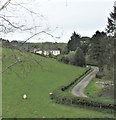
Farm house and buildings on a drumlin overlooking the Quoile River
Image: © Eric Jones Taken: 22 Apr 2017
0.03 miles
2
Fallen tree by the Quoile
At first glance this fallen tree appears to be dead. A closer look reveals leaves opening on the smaller branches.
Image: © Albert Bridge Taken: 4 Apr 2008
0.04 miles
3
Floodgates, River Quoile
Walking across the top of the floodgates on the Quoile Image is now strictly forbidden. And the fence makes it quite difficult to attempt even if you wanted to.......
Image: © Rossographer Taken: 26 Feb 2009
0.04 miles
4
Autumn, Quoile Pondage near Downpatrick
At 15.45 the autumn colours were enhanced by the late-afternoon sun.
Image: © Albert Bridge Taken: 31 Oct 2009
0.04 miles
5
Lifebuoy by the Quoile
Lifebuoy by the Quoile near Downpatrick.
Image: © Rossographer Taken: 26 Feb 2009
0.05 miles
6
Flooding, Quoile Pondage (5)
See Image Despite some heavy and persistent rain over the last 2-3 weeks the pondage did not reach the level shown earlier in this sequence. This flooded area lies between the path and the Quoile Road. Continue to Image
Image: © Albert Bridge Taken: 16 Aug 2008
0.05 miles
7
Blackberries near Downpatrick
Ripening blackberries close to the Quoile – a sign that summer doesn’t last for ever.
Image: © Albert Bridge Taken: 28 Jul 2008
0.05 miles
8
Lords and ladies, Quoile Pondage
Very few growing here – this one is among the wet ivy leaves.
Image: © Albert Bridge Taken: 16 Aug 2008
0.05 miles
9
Plaque by the Quoile Floodgates
Heavily defaced plaque by the floodgates on the River Quoile - see Image It basically lists the various flood defences that have been erected on the Quoile over the centuries: OLD FLOODGATES 1745 Edward Southwell's first automatic gates 1801 Lock gates operated by Edgar family 1884 Old floodgates constructed 1957 New barrage downstream at Hare Island 1992 Amenity area opened by the DoE (NI) QUOILE PONDAGE
Image: © Rossographer Taken: 26 Feb 2009
0.05 miles
10
Quoile floodgates, Downpatrick (2)
The upstream side of the floodgates.
Image: © Albert Bridge Taken: 28 Feb 2011
0.06 miles
  • ...