Plaque by the Quoile Floodgates
Introduction
The photograph on this page of Plaque by the Quoile Floodgates by Rossographer as part of the Geograph project.
The Geograph project started in 2005 with the aim of publishing, organising and preserving representative images for every square kilometre of Great Britain, Ireland and the Isle of Man.

There are currently over 7.5m images from over 14,400 individuals and you can help contribute to the project by visiting https://www.geograph.org.uk
Plaque by the Quoile Floodgates
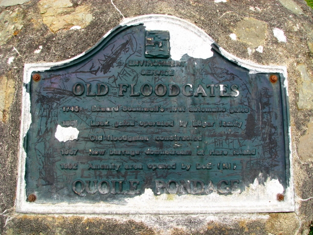
Image: © Rossographer Taken: 26 Feb 2009
Heavily defaced plaque by the floodgates on the River Quoile - see Image It basically lists the various flood defences that have been erected on the Quoile over the centuries: OLD FLOODGATES 1745 Edward Southwell's first automatic gates 1801 Lock gates operated by Edgar family 1884 Old floodgates constructed 1957 New barrage downstream at Hare Island 1992 Amenity area opened by the DoE (NI) QUOILE PONDAGE
Images are licensed for reuse under creativecommons.org/licenses/by-sa/2.0
Image Location
Latitude
54.345264
Longitude
-5.710065