
IMAGES TAKEN NEAR TO
Strangford Road, DOWNPATRICK, BT30 7SJ
Introduction
This page details the photographs taken nearby to Strangford Road, BT30 7SJ by members of the Geograph project.
The Geograph project started in 2005 with the aim of publishing, organising and preserving representative images for every square kilometre of Great Britain, Ireland and the Isle of Man.

There are currently over 7.5m images from over14,400 individuals and you can help contribute to the project by visiting https://www.geograph.org.uk
Image Map
Images are licensed for reuse under creativecommons.org/licenses/by-sa/2.0
Notes
- Clicking on the map will re-center to the selected point.
- The higher the marker number, the further away the image location is from the centre of the postcode.
Image Listing (22 Images Found)
Images are licensed for reuse under creativecommons.org/licenses/by-sa/2.0
Image
Details
Distance
1
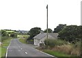
Bungalow on the A2 at Ardtole near Ardglass
Image: © Eric Jones
Taken: 22 Jul 2013
0.02 miles
2
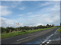
View northwards along the Strangford Road (A2)
The signs remind drivers that the Strangford Ferry (linking Strangford and Portaferry) makes its last crossing of the day at 23.30hrs.
Image: © Eric Jones
Taken: 20 Aug 2009
0.05 miles
3
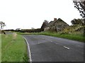
Derelict farm worker's cottage alongside the A2 road
Image: © Eric Jones
Taken: 23 Sep 2011
0.06 miles
4
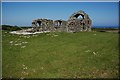
Ardtole church (ruin) near Ardglass
Ardtole church (dedicated to St Nicholas) is thought to date from the 15th century. Excavations suggest that there might have been a church on the site some 300 years earlier.
Image: © Albert Bridge
Taken: 7 Jun 2007
0.07 miles
5
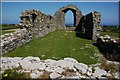
Ardtole church (ruin) near Ardglass (2)
See Image A view of what would have been the interior of the church. The thickness of the walls is particularly noticeable.
Image: © Albert Bridge
Taken: 7 Jun 2007
0.07 miles
6
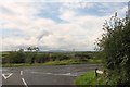
The junction of Sheepland Road with the A2 at Ardtole
Image: © Eric Jones
Taken: 20 Aug 2009
0.12 miles
7
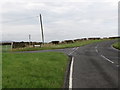
The junction of the Ballyedock Road and the Strangford Road (A2)
Image: © Eric Jones
Taken: 23 Sep 2011
0.12 miles
8
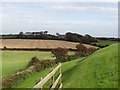
Farmland and disused farmhouse on the Sheepland Road
This view was taken from the ruined church at Ardtole.
Image: © Eric Jones
Taken: 23 Sep 2011
0.13 miles
10
The Ballyedock Road from the A2 at Ardtole
This road plunges into the depth of the Lecale countryside.
Image: © Eric Jones
Taken: 20 Aug 2009
0.16 miles