
IMAGES TAKEN NEAR TO
Hungry House Lane, LISBURN, BT28 3XB
Introduction
This page details the photographs taken nearby to Hungry House Lane, BT28 3XB by members of the Geograph project.
The Geograph project started in 2005 with the aim of publishing, organising and preserving representative images for every square kilometre of Great Britain, Ireland and the Isle of Man.

There are currently over 7.5m images from over14,400 individuals and you can help contribute to the project by visiting https://www.geograph.org.uk
Image Map
Images are licensed for reuse under creativecommons.org/licenses/by-sa/2.0
Notes
- Clicking on the map will re-center to the selected point.
- The higher the marker number, the further away the image location is from the centre of the postcode.
Image Listing (8 Images Found)
Images are licensed for reuse under creativecommons.org/licenses/by-sa/2.0
Image
Details
Distance
1

Hungry House Lane, Magheragall
This unusually named minor road links the Sheepwalk Road leading northwest from Derriaghy with the Lisburn to Glenavy Road, between the townlands of Ballynadolly and Ballycarrickmaddy.
With regard to the name, the only information I have been able to find online comes from the 1986 BBC Domesday project. The contributors to the project suggested two theories: 1 - a whole household here died of starvation during the Irish Famine of the 1840s; 2 - there was a place here where food was distributed during the Famine. Any further information would be greatly appreciated.
Image: © Dean Molyneaux
Taken: 16 Mar 2014
0.08 miles
2
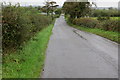
Hungry House Lane
Looking down Hungry House Lane in a northerly direction. The few houses on this road are quite posh and not at all hungry looking. Was there maybe a workhouse here in years gone by?
Image: © Robert Ashby
Taken: 20 Oct 2013
0.11 miles
4
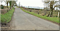
Hungry House Lane, Ballynadolly, Stonyford/Lisburn (March 2016)
A minor road, through pleasant countryside, connecting the Sheepwalk Road (behind me) to the Glenavy Road. The townland of Ballynadolly is mentioned in the Glenavy History website http://glenavyhistory.com/ with references from the Ordnance Survey Memoirs http://glenavyhistory.com/townlands/townlands-magheragall-parish/ballynadolly-townland-magheragall-parish/ but still no indication of how the name came about.
Previously seen in Image (October 2013) and Image (March 2014).
Image: © Albert Bridge
Taken: 21 Mar 2016
0.17 miles
5
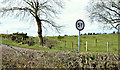
Weight restriction sign, Ballynadolly, Stonyford/Lisburn (March 2016)
A sign, at the Sheepwalk Road end of Hungry House Lane Image, showing a weight restriction of five tonnes. I didn’t see any bridges or culverts so the restriction might be due to the slightly soft nature of the surrounding land.
Image: © Albert Bridge
Taken: 21 Mar 2016
0.21 miles
6
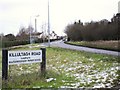
Glenavy Road at Ballynadolly
The Lisburn-Glenavy A30 road where the Killultagh Road (the old road to Glenavy) branches off to the left.
Image: © Dean Molyneaux
Taken: 26 Dec 2009
0.21 miles
7
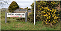
Name sign, Hungry House Lane, Ballynadolly, Stonyford/Lisburn (March 2016)
The name sign at the Sheepwalk Road end of Hungry House Lane Image
Image: © Albert Bridge
Taken: 21 Mar 2016
0.22 miles
8
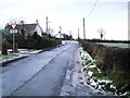
Approaching the main Glenavy Road at Ballynadolly
The Killutagh Road approaching the A30 Glenavy Road.
Image: © Dean Molyneaux
Taken: 26 Dec 2009
0.25 miles