IMAGES TAKEN NEAR TO
Antrim Road, LISBURN, BT28 3DN

Introduction

This page details the photographs taken nearby to Antrim Road, BT28 3DN by members of the Geograph project.

The Geograph project started in 2005 with the aim of publishing, organising and preserving representative images for every square kilometre of Great Britain, Ireland and the Isle of Man.

There are currently over 7.5m images from over14,400 individuals and you can help contribute to the project by visiting https://www.geograph.org.uk

Image Map


Images are licensed for reuse under creativecommons.org/licenses/by-sa/2.0
Notes
  • Clicking on the map will re-center to the selected point.
  • The higher the marker number, the further away the image location is from the centre of the postcode.

Image Listing (7 Images Found)

Images are licensed for reuse under creativecommons.org/licenses/by-sa/2.0
Image
Details
Distance
1
Letter box, Lisburn
Post-mounted EIIR letter box, on the Antrim Road near Thornleigh Drive.
Image: © Albert Bridge Taken: 17 Jul 2011
0.09 miles
2
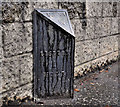
Milepost, Lisburn (3)
A milepost, on the Antrim Road inward of Thornleigh Drive, showing distances, in statute miles, to Lisburn, Antrim and Crumlin Image
Image: © Albert Bridge Taken: 17 Jul 2011
0.12 miles
3
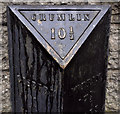
Milepost, Lisburn (4)
See Image The distances, in statute miles, to Lisburn (1), Crumlin (10½) and Antrim (17½). This Image did not exist in the era of the milepost.
Image: © Albert Bridge Taken: 17 Jul 2011
0.12 miles
4
Jennings access cover, Lisburn
A wet and worn access cover, on the Antrim Road near Benavon Court. It has the inscription “G JENNINGS LONDON”. I can only offer two suggestions http://en.wikipedia.org/wiki/George_Jennings and http://www.jenningsfoundry.com/aboutus.html. Further information very welcome. For another example. In Lisburn, see Image
Image: © Albert Bridge Taken: 17 Jul 2011
0.15 miles
5
Recycling bins, Lisburn (2)
Recycling bins in the Tesco car park on the Bentrim Road.
Image: © Albert Bridge Taken: 2 Dec 2012
0.21 miles
6
Lisburn fire station
The present Lisburn fire station, on the Prince William Road. It opened in 1992 replacing one (since demolished and the site redeveloped) in Antrim Street on the inward side of the railway bridge Image More information here http://homepage.ntlworld.com/bill.broadhurst/pageseven.htm. Last seen in Image (October 2005).
Image: © Albert Bridge Taken: 2 Dec 2012
0.23 miles
7
Clarksteel manhole cover, Lisburn
A Clarksteel http://www.clark-drain.com/ manhole cover, at the Thiepval Road end of the Bentrim Road.
Image: © Albert Bridge Taken: 14 Aug 2011
0.25 miles