Lisburn fire station
Introduction
The photograph on this page of Lisburn fire station by Albert Bridge as part of the Geograph project.
The Geograph project started in 2005 with the aim of publishing, organising and preserving representative images for every square kilometre of Great Britain, Ireland and the Isle of Man.

There are currently over 7.5m images from over 14,400 individuals and you can help contribute to the project by visiting https://www.geograph.org.uk
Lisburn fire station
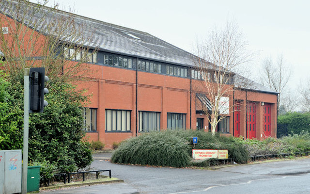
Image: © Albert Bridge Taken: 2 Dec 2012
The present Lisburn fire station, on the Prince William Road. It opened in 1992 replacing one (since demolished and the site redeveloped) in Antrim Street on the inward side of the railway bridge Image More information here http://homepage.ntlworld.com/bill.broadhurst/pageseven.htm. Last seen in Image (October 2005).
Images are licensed for reuse under creativecommons.org/licenses/by-sa/2.0
Image Location
Latitude
54.515612
Longitude
-6.057912