
IMAGES TAKEN NEAR TO
Hertford Crescent, LISBURN, BT28 1SY
Introduction
This page details the photographs taken nearby to Hertford Crescent, BT28 1SY by members of the Geograph project.
The Geograph project started in 2005 with the aim of publishing, organising and preserving representative images for every square kilometre of Great Britain, Ireland and the Isle of Man.

There are currently over 7.5m images from over14,400 individuals and you can help contribute to the project by visiting https://www.geograph.org.uk
Image Map
Images are licensed for reuse under creativecommons.org/licenses/by-sa/2.0
Notes
- Clicking on the map will re-center to the selected point.
- The higher the marker number, the further away the image location is from the centre of the postcode.
Image Listing (23 Images Found)
Images are licensed for reuse under creativecommons.org/licenses/by-sa/2.0
Image
Details
Distance
1

Pillar box, Lisburn
EIIR pillar box (BT28 6) at Knockmore Square. The Moira Road is in the background.
Image: © Albert Bridge
Taken: 8 Apr 2012
0.05 miles
2
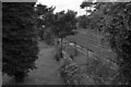
Knockmore Halt
The closed Knockmore Halt as viewed from the Ballinderry Road Bridge, looking towards Portadown.
Image: © Wilson Adams
Taken: 23 Jul 2005
0.13 miles
3
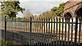
The Ballinderry Road, Lisburn (old alignment)
One of the side effects of the building of the Belfast – Dublin railway was the (slight) realignment of the Ballinderry Road and its replacement by the bridge Image on the right. The original alignment can be seen between the two fence posts on the left. The railway opened here in 1841. The old alignment survived intact until relatively recently but there are now commercial premises at the far end. This view is from the south eastern side, near Ballycreen Drive.
Image: © Albert Bridge
Taken: 14 Apr 2013
0.14 miles
4
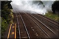
Fire, at Knockmore Halt
Vandals set fire to the grass bank across the line from Knockmore Halt.
Image: © Wilson Adams
Taken: 23 Jul 2005
0.14 miles
5
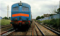
Railway works near Lisburn
The civil engineer’s department had absolute possession of the down line between Lisburn and Moira for relaying. The MV class locomotive was hauling a “Donelli” train of track panels (sections of rail attached to sleepers ready to be laid and welded as continuous welded rail). Single-line working was in operation over the up line (right). The line on the left is the single line from Antrim Image
This was in the days before health and safety regulations – railway staff either nodded a greeting or ignored you completely.
Image: © Albert Bridge
Taken: 6 Jul 1987
0.14 miles
6
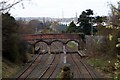
Ballinderry Road Bridge/Knockmore Halt
(right) Knockmore Halt on the Lisburn to Antrim Branch, (centre and left) the Belfast to Dublin mainline. The Ballindery Road bridge in the centre of the photo, this replaced the level crossing that was previously at this location in the 1920's.
It should also be noted that trains don't stop at the Halt any more.
Image: © Wilson Adams
Taken: 13 Apr 2008
0.15 miles
7
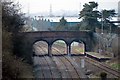
Knockmore Halt
(right) Knockmore Halt on the Lisburn to Antrim Branch, (centre and left) the Belfast to Dublin mainline. The Ballindery Road bridge in the centre of the photo, this replaced the level crossing that was previously at this location in the 1920's.
Image: © Wilson Adams
Taken: 25 Mar 2007
0.15 miles
8
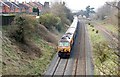
Railway Tracks
The 13:00 Belfast to Dublin Enterprise passing Knockmore Halt on its journey to Dublin. The Knockmore Halt platforms are on either side of the Ballinderry Road bridge.
Image: © Wilson Adams
Taken: 25 Mar 2007
0.15 miles
9
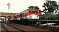
"Sealink train". Knockmore, Lisburn
See Image The “Sealink” set passing Knockmore station with the 17.45 Portadown – Bangor. The platform on the other side of the Ballinderry Road bridge served the (single) third line to Antrim. That on the right was used by up trains to Portadown on the Dublin line. Due to insufficient space there was no equivalent down platform. The semaphore signal is the Lisburn down distant.
Image: © Albert Bridge
Taken: 27 Aug 1984
0.15 miles
10
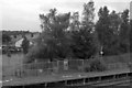
Knockmore Halt
The closed Knockmore Halt on the Antrim Branch.
Image: © Wilson Adams
Taken: 23 Jul 2005
0.15 miles