The Ballinderry Road, Lisburn (old alignment)
Introduction
The photograph on this page of The Ballinderry Road, Lisburn (old alignment) by Albert Bridge as part of the Geograph project.
The Geograph project started in 2005 with the aim of publishing, organising and preserving representative images for every square kilometre of Great Britain, Ireland and the Isle of Man.

There are currently over 7.5m images from over 14,400 individuals and you can help contribute to the project by visiting https://www.geograph.org.uk
The Ballinderry Road, Lisburn (old alignment)
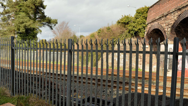
Image: © Albert Bridge Taken: 14 Apr 2013
One of the side effects of the building of the Belfast – Dublin railway was the (slight) realignment of the Ballinderry Road and its replacement by the bridge Image on the right. The original alignment can be seen between the two fence posts on the left. The railway opened here in 1841. The old alignment survived intact until relatively recently but there are now commercial premises at the far end. This view is from the south eastern side, near Ballycreen Drive.
Images are licensed for reuse under creativecommons.org/licenses/by-sa/2.0
Image Location
Latitude
54.511042
Longitude
-6.069864