
IMAGES TAKEN NEAR TO
Bow Street, LISBURN, BT28 1BN
Introduction
This page details the photographs taken nearby to Bow Street, BT28 1BN by members of the Geograph project.
The Geograph project started in 2005 with the aim of publishing, organising and preserving representative images for every square kilometre of Great Britain, Ireland and the Isle of Man.

There are currently over 7.5m images from over14,400 individuals and you can help contribute to the project by visiting https://www.geograph.org.uk
Image Map
Images are licensed for reuse under creativecommons.org/licenses/by-sa/2.0
Notes
- Clicking on the map will re-center to the selected point.
- The higher the marker number, the further away the image location is from the centre of the postcode.
Image Listing (400 Images Found)
Images are licensed for reuse under creativecommons.org/licenses/by-sa/2.0
Image
Details
Distance
1
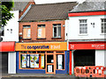
The Co-op Travel, Lisburn (May 2014)
A branch of The Co-operative Travel agency, at 4 Antrim Street, occupying what had been Thomas Cook’s “Going Places” until the merger announced in 2010. The Co-op already had a branch on the other side of the street. The estate agency (right) was previously a branch of “Jessops”.
Image: © Albert Bridge
Taken: 18 May 2014
0.02 miles
2
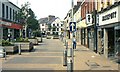
Bow Street, Lisburn (1983)
Bow Street looking towards Antrim Street. Five points to note: Woolworth’s (left) and Easiephit (right) now names from retail history, the Abbey National (next to Easiephit) six years before demutualisation and eight before shedding its “umbrella” logo, streets were not swept on a Sunday in those far-off days and Lisburn was still but a humble town.
Image: © Albert Bridge
Taken: 10 Jul 1983
0.02 miles
3
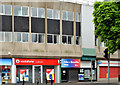
Bow House (part), Lisburn (May 2014)
To the best of my knowledge this building was a speculative development of the 1970’s, the offices of which have always been occupied by what was then known as “the Broo” (“Jobs and Benefits” in the 21st century). It follows the curve of Bow Street and is one of the surviving examples of the concrete panel school of architecture – see also Image and Image Now known as 71 Bow Street. This view is from Antrim Street.
Image: © Albert Bridge
Taken: 18 May 2014
0.02 miles
4
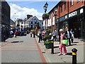
Lisburn City
A view of the main pedestrian shopping area
Image: © Kenneth Allen
Taken: 4 Jul 2008
0.02 miles
5
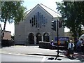
First Lisburn Presbyterian Church
It is located near the city centre
Image: © Kenneth Allen
Taken: 4 Jul 2008
0.02 miles
6
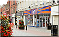
"b&m" shop, Lisburn (September 2014)
A “b&m” shop in the former Woolworths - left in Image
Image: © Albert Bridge
Taken: 14 Sep 2014
0.02 miles
7
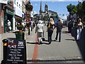
Lisburn City
Looking towards Market Square - some Ulster towns would have called this area The Diamond
Image: © Kenneth Allen
Taken: 4 Jul 2008
0.02 miles
8
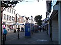
Businesses in Bow Street
Most of Bow Street is pedestrianised.
Image: © Eric Jones
Taken: 12 Oct 2012
0.03 miles
9
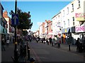
View west along the pedestrianised section of Bow Street, Lisburn
Image: © Eric Jones
Taken: 12 Oct 2012
0.03 miles
10
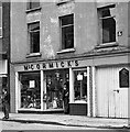
McCormick's - Bow Street, Lisburn - May 1976
"McCormick's" was a traditional "needle to an anchor" shop on Bow Street, Lisburn which was popular as it sold "loyalist" regalia. The exact fate of this business is now uncertain - as is the location - as Bow Street was devastated by a terrorist bomb in 1981 and substantially rebuilt.
Image: © The Carlisle Kid
Taken: Unknown
0.04 miles