
IMAGES TAKEN NEAR TO
Dublin Road, BELFAST, BT2 7HP
Introduction
This page details the photographs taken nearby to Dublin Road, BT2 7HP by members of the Geograph project.
The Geograph project started in 2005 with the aim of publishing, organising and preserving representative images for every square kilometre of Great Britain, Ireland and the Isle of Man.

There are currently over 7.5m images from over14,400 individuals and you can help contribute to the project by visiting https://www.geograph.org.uk
Image Map
Images are licensed for reuse under creativecommons.org/licenses/by-sa/2.0
Notes
- Clicking on the map will re-center to the selected point.
- The higher the marker number, the further away the image location is from the centre of the postcode.
Image Listing (1372 Images Found)
Images are licensed for reuse under creativecommons.org/licenses/by-sa/2.0
Image
Details
Distance
1
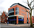
Nos 74&76 Dublin Road, Belfast (8)
See Image For the record, the ground floor is now occupied by an office of the European Commission. Continue to Image
Image: © Albert Bridge
Taken: 5 Apr 2010
0.00 miles
2
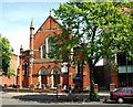
Shaftesbsury Square Reformed Presbyterian Church, Belfast
Built towards the end of the 19th century (closest date I can find), on the Dublin Road. Image shows work underway to provide a disabled access.
Image: © Albert Bridge
Taken: 9 Jun 2009
0.01 miles
3

Nos 74 & 76 Dublin Road, Belfast (5)
See Image The brickwork seems to be complete with the glazing now being installed. Continue to Image
Image: © Albert Bridge
Taken: 21 Sep 2008
0.01 miles
4
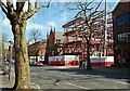
Nos 74 & 76 Dublin Road, Belfast (2)
See Image The structural steelwork for the replacement building is now being erected. Continue to Image
Image: © Albert Bridge
Taken: 13 Apr 2008
0.01 miles
5
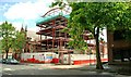
Nos 74&76 Dublin Road, Belfast (3)
Image: © Albert Bridge
Taken: 29 Jun 2008
0.01 miles
6
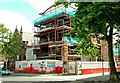
Nos 74 & 76 Dublin Road, Belfast (4)
Image: © Albert Bridge
Taken: 3 Aug 2008
0.01 miles
7
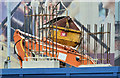
Nos 78-86 Dublin Road, Belfast - August 2016(1)
The structure now appearing above the hoarding. Packenham Street is in the background.
Image: © Albert Bridge
Taken: 4 Aug 2016
0.01 miles
8

Shaftesbury Square Reformed Presbyterian church, Belfast (May 2017)
See Image (June 2009). The provision of a disabled access at the Dublin Road entrance “Z/2014/1514/F Alterations to provide disabled access at the front of the church and to provide an extension to the hall for a disabled lift 72 Dublin Road Belfast BT2 7HP” (approved 3 February 2015).
Image: © Albert Bridge
Taken: 27 May 2017
0.01 miles
9
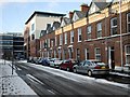
Snow on Pakenham Street
Pakenham Street in Belfast shortly after a heavy snowfall. See also Image
Image: © Rossographer
Taken: 6 Jan 2010
0.02 miles
10
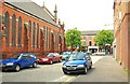
Hartington Street, Belfast
Hartington Street ran from Maryville Street to the Dublin Road (background). Much of the area between Bankmore Street and Donegall Pass was redeveloped in the 1980’s. Salisbury Court Image (behind me) replaced the eastern part of the street although there is now a short stretch (behind me to my right) under the name but on a different line from the old Hartington Street.
Image: © Albert Bridge
Taken: 24 May 2009
0.02 miles